Historic Markers and Wayside Interpretive Panels
in the Villages of Champlain and Rouses Point
and the
Town of Champlain
The Town of Champlain in upstate New York has a rich history. Historic markers, plaques and wayside panels denote historic sites, famous people and events that have occurred in the town. The town and its two villages of Champlain and Rouses Point were witness to events during the French and Indian War, the Revolutionary War, the War of 1812, the Pappineau War in Quebec, the Abolitionist Movement, the American Civil War, Temperance, Prohibition and many other events.
Numerous industries were created in the town and villages that employed hundreds, and sometimes thousands, of workers. This includes the lumber and mill trade, canal boat building, shipping, iron manufacturing, transportation via steamboat, railroading, customs enforcement as well as modern pharmaceuticals.
Many blue and yellow historic markers and modern wayside interpretive panels have been created to commemorate historical events and sites in and around the Town of Champlain and its two villages.
Numerous industries were created in the town and villages that employed hundreds, and sometimes thousands, of workers. This includes the lumber and mill trade, canal boat building, shipping, iron manufacturing, transportation via steamboat, railroading, customs enforcement as well as modern pharmaceuticals.
Many blue and yellow historic markers and modern wayside interpretive panels have been created to commemorate historical events and sites in and around the Town of Champlain and its two villages.
Village of Champlain
In August of 1938, the Town of Champlain celebrated the 150th anniversary of its founding. The town was created by the New York State legislature on March 7, 1788. A young soldier named Pliny Moore had acquired 11,600 acres of land in the town in 1785 and was working on bringing settlers to Champlain. He wrote his state representative in January of 1788 and urged the state to create the town and county of Clinton. Moore came to Champlain on his third visit in the summer of 1788 to build a sawmill in today's Perry's Mills.
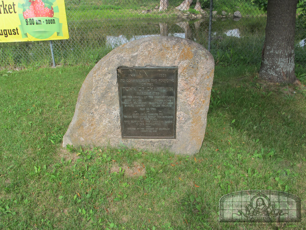
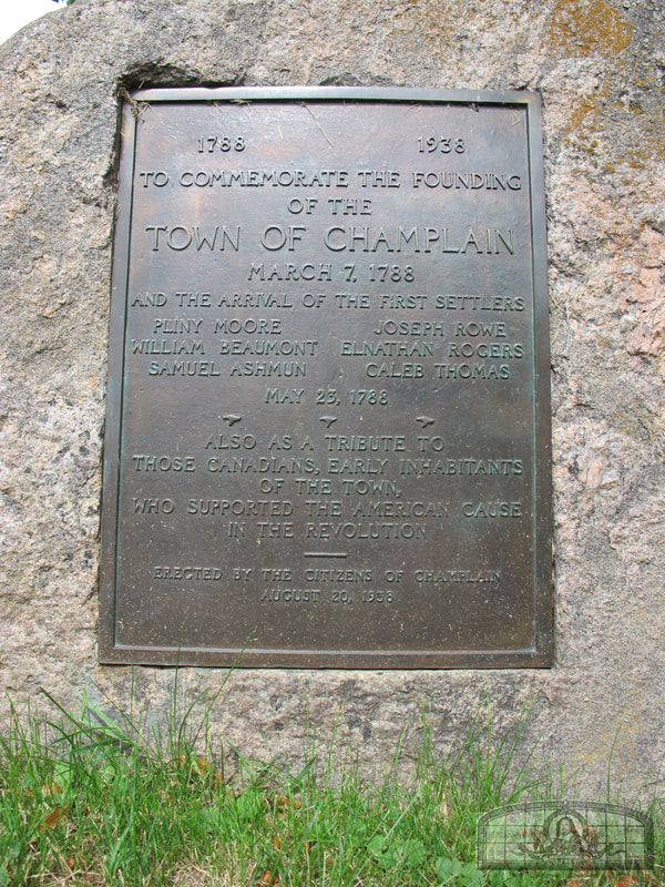
In 1938, the Village of Champlain, with the assistance of architect and historian Hugh McLellan (1874-1963), erected a bronze marker at the site of Village Hall (the former Presbyterian Church at the corner of Main and Church Streets). The marker commemorated the first settlers who arrived in 1788 to build the sawmill: Pliny Moore (former soldier and surveyor of Champlain), William Beaumont (surveyor and uncle to the future Dr. William Beaumont), Samuel Ashmun (father of Jehudi Ashmun), Joseph Rowe, Elnathan Rogers (brother-in-law of Pliny Moore) and Caleb Thomas (blacksmith). All of the settlers were former soldiers who had earned land bounties for their service in the New York State militia during the Revolutionary War. It should be noted that Hugh McLellan was the great-great grandson of Pliny Moore.
Planning Committee for 1938 celebration:
Six blue and yellow historic markers were dedicated in Champlain Village and one near Perry's Mills.
Memorial Tablet and Historical Markers Are Erected At Champlain
(North Countryman, September 8, 1938)
Perhaps the most interesting event on the very elaborate program presented at the Champlain Sesquicentennial on August 20, 1938, in honor of the founding of the town 150 years before, was the dedication of the memorial tablet attached to a huge boulder permanently placed in position in front of the Village Hall. While hundreds of persons saw the dedication and heard the dedicatory remarks of the speakers, there were many who did not have the opportunity to read the inscription on the tablet. It follows:
Inscriptions on the six historical markers placed at sites in and near the village are as follows:
In 1938, the Village of Champlain, with the assistance of architect and historian Hugh McLellan (1874-1963), erected a bronze marker at the site of Village Hall (the former Presbyterian Church at the corner of Main and Church Streets). The marker commemorated the first settlers who arrived in 1788 to build the sawmill: Pliny Moore (former soldier and surveyor of Champlain), William Beaumont (surveyor and uncle to the future Dr. William Beaumont), Samuel Ashmun (father of Jehudi Ashmun), Joseph Rowe, Elnathan Rogers (brother-in-law of Pliny Moore) and Caleb Thomas (blacksmith). All of the settlers were former soldiers who had earned land bounties for their service in the New York State militia during the Revolutionary War. It should be noted that Hugh McLellan was the great-great grandson of Pliny Moore.
Planning Committee for 1938 celebration:
- Arsene Tremblay, Honorary Chairman
- A. J. V. Durbin, Chairman
- C. W. McLellan (Woody), Secretary
- Philip Agel, Finance
- Hugh McLellan, Historian and Markers
- Mrs. Mary Deal, Mrs. Lola Nason and J. J. Fallon, Tickets
- Walter B. Spelman, Dinner Program
- Decorations, Clarke Washburn
- Banquet, Mrs. George Glode
- Publicity, Oscar E. Bredenberg
Six blue and yellow historic markers were dedicated in Champlain Village and one near Perry's Mills.
Memorial Tablet and Historical Markers Are Erected At Champlain
(North Countryman, September 8, 1938)
Perhaps the most interesting event on the very elaborate program presented at the Champlain Sesquicentennial on August 20, 1938, in honor of the founding of the town 150 years before, was the dedication of the memorial tablet attached to a huge boulder permanently placed in position in front of the Village Hall. While hundreds of persons saw the dedication and heard the dedicatory remarks of the speakers, there were many who did not have the opportunity to read the inscription on the tablet. It follows:
Inscriptions on the six historical markers placed at sites in and near the village are as follows:
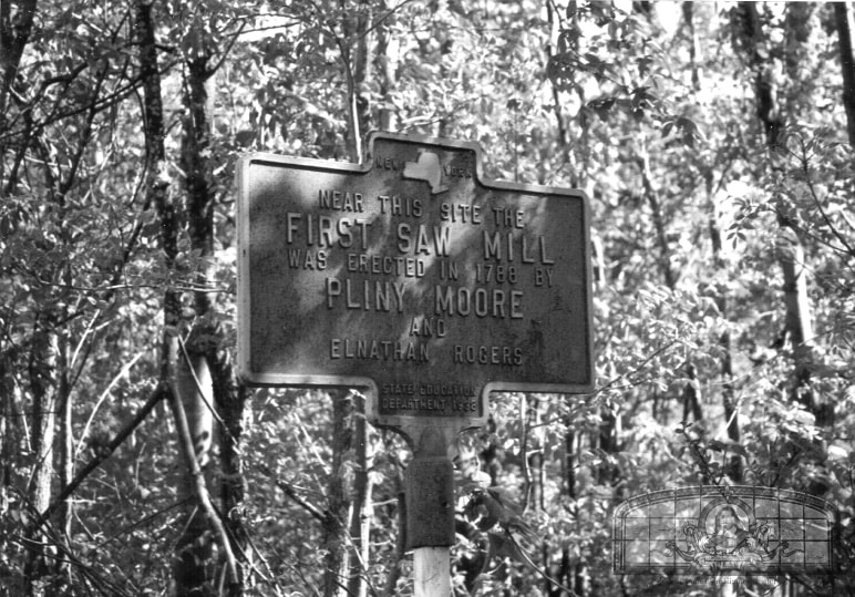
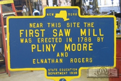
- "Near this Site the First Saw Mill Was Erected In 1788 by Pliny Moore and Elnathan Rogers"
- "East Battery. On this Hill Was Encamped the Artillery of the American Army Under Gen. George Izard, 1814."
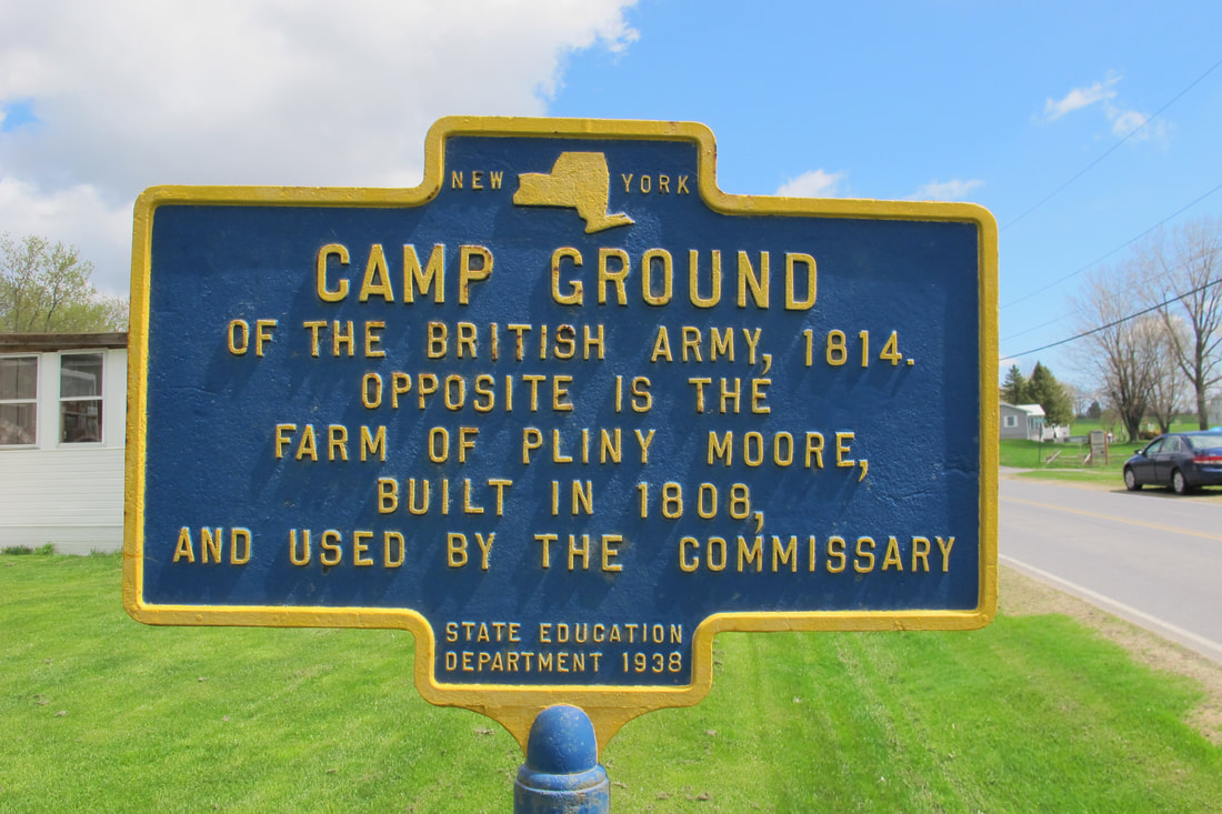
- "Camp Ground of the British Army, 1814. Opposite is the Farm of Pliny Moore, Built in 1808, and Used by the Commissary"
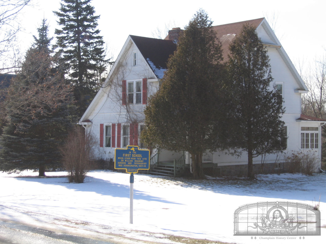
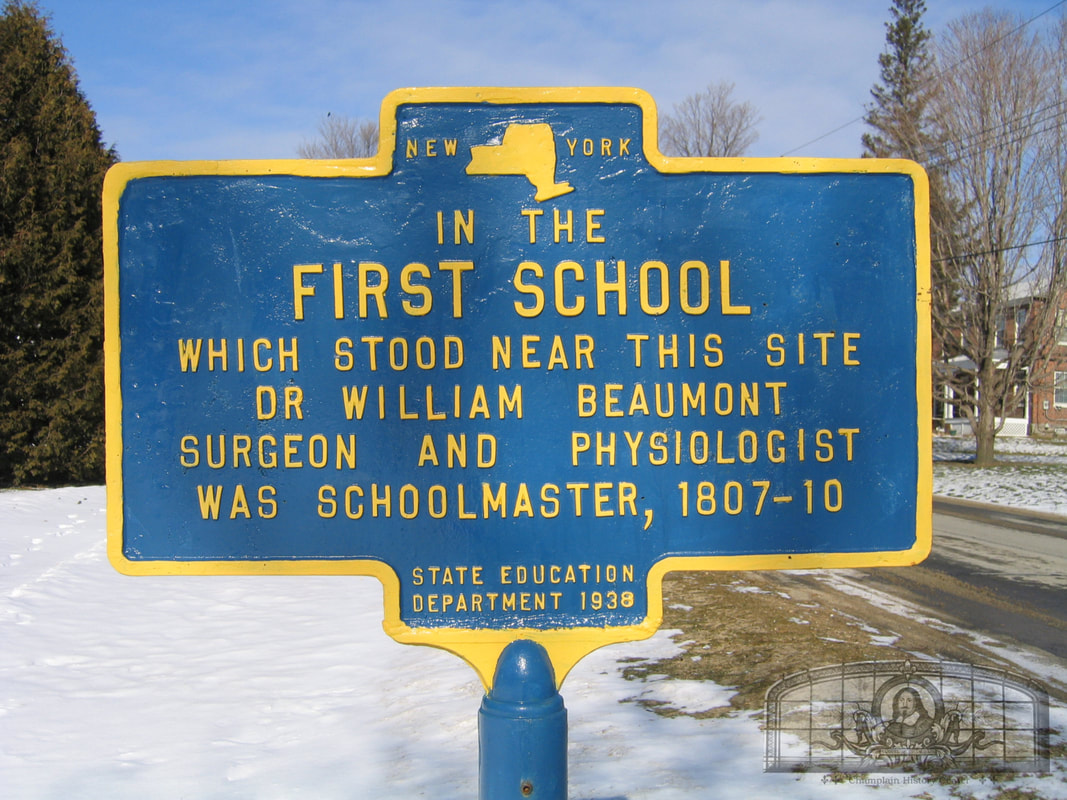
- “First School, Which Stood Near This Site, Dr. William Beaumont, Surgeon and Physiologist, was Schoolmaster, 1807—10”
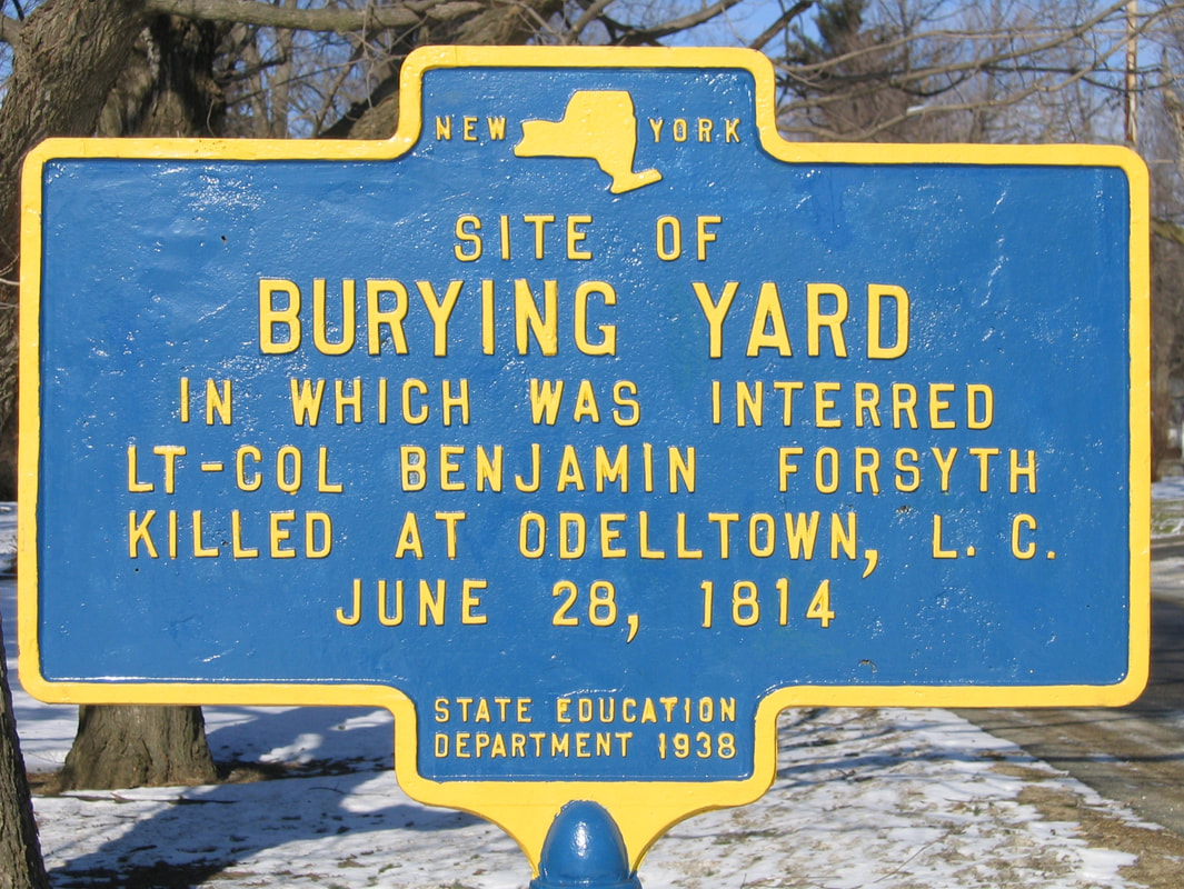
- “Site of the Burying Yard in Which Was Interred Lt.-Col. Benjamin Forsyth, Killed at Odelltown, L. C., June 28, 1814”.
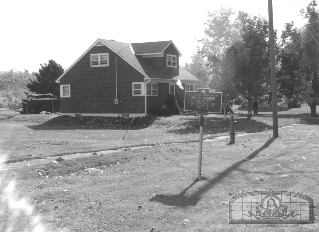
- "Site of the Birthplace of Jehudi Ashmun, April 21, 1794, First Colonization Agent At Liberia, Africa, 1822‑1828".
1788 1938
TO COMMEMORATE THE FOUNDING
OF THE
TOWN OF CHAMPLAIN
MARCH 7, 1788
AND THE ARRIVAL OF THE FIRST SETTLERS
PLINY MOORE JOSEPH ROWE
WILLIAM BEAUMONT ELNATHAN ROGERS
SAMUEL ASHMUN CALEB THOMAS
MAY 23, 1788
ALSO AS A TRIBUTE TO
THOSE CANADIANS, EARLY INHABITANTS OF THE
TOWN, WHO SUPPORTED THE AMERICAN CAUSE
IN THE REVOLUTION.
ERECTED BY THE CITIZENS OF CHAMPLAIN
AUGUST 20, 1938.
TO COMMEMORATE THE FOUNDING
OF THE
TOWN OF CHAMPLAIN
MARCH 7, 1788
AND THE ARRIVAL OF THE FIRST SETTLERS
PLINY MOORE JOSEPH ROWE
WILLIAM BEAUMONT ELNATHAN ROGERS
SAMUEL ASHMUN CALEB THOMAS
MAY 23, 1788
ALSO AS A TRIBUTE TO
THOSE CANADIANS, EARLY INHABITANTS OF THE
TOWN, WHO SUPPORTED THE AMERICAN CAUSE
IN THE REVOLUTION.
ERECTED BY THE CITIZENS OF CHAMPLAIN
AUGUST 20, 1938.
Blue and Yellow Historic Markers Dedicated in 1938
FIRST SCHOOL
------------------------
FIRST SCHOOL
WHICH STOOD NEAR THIS SITE
DR. WILLIAM BEAUMONT
SURGEON AND PSYCHOLOGIST
WAS SCHOOLMASTER 1807-1810
(State Education Department 1938)
[Oak St.]
BURYING YARD
----------------------------
SITE OF
BURYING YARD
IN WHICH WAS INTERRED
LT. COL. BENJAMIN FORSYTH
KILLED AT ODELLTOWN, L.C.
JUNE 28, 1814
(State Education Department 1938)
[Oak St.]
ASHMUN BIRTHPLACE SITE
-----------------------------------------------
SITE OF THE BIRTHPLACE OF
JEHUDI ASHMUN
APRIL 21, 1794
FIRST COLONIZATION AGENT
AT LIBERIA, AFRICA
1822-1828
(State Education Department 1938)
[Oak St.]
AMERICAN BLOCKHOUSE AND BRITISH ENCAMPMENT
------------------------------------------------------------------------------------
CAMP GROUND
OF THE BRITISH ARMY 1814
OPPOSITE IS THE
FARM OF PLINY MOORE
BUILT IN 1808
AND USED BY THE COMMISSARY
(State Education Department 1938)
[Prospect St.]
AMERICAN GENERAL GEORGE IZARD'S ENCAMPMENT
-------------------------------------------------------------------------------
EAST BATTERY
ON THIS HILL WAS ENCAMPED
THE ARTILLERY OF THE
AMERICAN ARMY
UNDER GEN. GEORGE IZARD
1814
(State Education Department 1938)
[The original 1938 marker disappeared decades ago
and a new one was placed near the site of the original on May 30, 2026]
[Pine St.]
FIRST SAWMILL IN THE TOWN
----------------------------------------------------
NEAR THIS SITE THE
FIRST SAWMILL
WAS ERECTED IN 1788 BY
PLINY MOORE
AND
ELNATHAN ROGERS
(State Education Department 1938)
[Located on Locust St. near Perry's Mills]
First School with Dr. William Beaumont as Teacher, Oak Street
William Beaumont (November 21, 1785 – April 25, 1853) was a resident of the Village of Champlain between 1807 and 1810. He taught school on Oak Street during these years. In 1810, he left Champlain and went to St. Albans, Vermont to train as a physician. He then entered the army and became a surgeon. It was during this time in the army that he studied human digestion and became known as the "Father of Gastric Physiology."
William Beaumont had an uncle named William Beaumont who was one of the first settlers of Champlain in 1788. This Beaumont was a surveyor who surveyed many areas of Champlain, including Point au Fer in 1805. The doctor also had another uncle who lived in Champlain.
GPS Location: 44.988694615892484, -73.44470831724276
William Beaumont had an uncle named William Beaumont who was one of the first settlers of Champlain in 1788. This Beaumont was a surveyor who surveyed many areas of Champlain, including Point au Fer in 1805. The doctor also had another uncle who lived in Champlain.
GPS Location: 44.988694615892484, -73.44470831724276
Burying Yard where Lieut. Col. Benjamin Forsyth is Interred, Oak Street
GPS Location: 44.99042311398693, -73.44467302762257
Jehudi Ashmun, Oak Street
Jehudi Ashmun (April 21, 1794 – August 25, 1828) was an American religious leader and social reformer who was born in Champlain, New York. He later traveled to the African nation of Liberia and became its first governor.
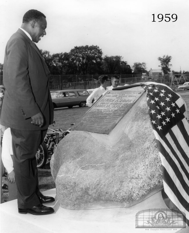
A blue and yellow historic marker notes the location of his birthplace. His house is not standing but it was noted over one hundred years ago that the foundation was still present. This marker was dedicated in August 1938. A second Ashmun marker was dedicated in August 1959 as part of the 350th Champlain Sesquicentennial celebrations. The marker was placed at the elementary school on Elm St. at the time but was moved in the 2010s to the village park on Main St.
GPS Location: 44.99476482165542, -73.44454257947257
A blue and yellow historic marker notes the location of his birthplace. His house is not standing but it was noted over one hundred years ago that the foundation was still present. This marker was dedicated in August 1938. A second Ashmun marker was dedicated in August 1959 as part of the 350th Champlain Sesquicentennial celebrations. The marker was placed at the elementary school on Elm St. at the time but was moved in the 2010s to the village park on Main St.
GPS Location: 44.99476482165542, -73.44454257947257
Camp Ground of the American and British Armies, Prospect Street
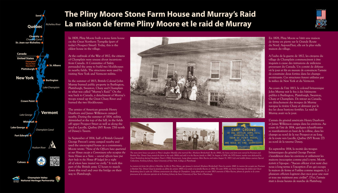
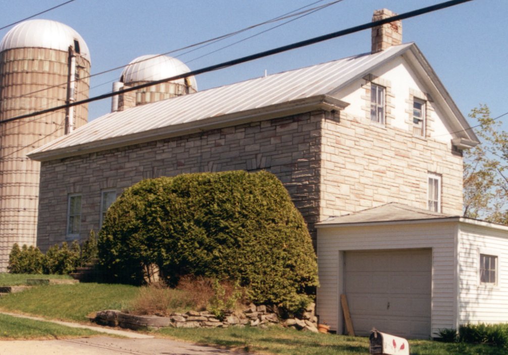
In 1808, Pliny Moore built a stone farm house on the Great Northern Turnpike (part of today’s Prospect Street). Today, this is the oldest house in the village.
At the outbreak of the War of 1812, the citizens of Champlain were uneasy about incursions from Canada. A Committee of Safety persuaded the army to build two blockhouses in nearby fields. The structures were used by visiting New York and Vermont militia.
In the summer of 1813, British Colonel John Murray burned public property in Burlington, Plattsburgh, Swanton, Chazy and Champlain in what was called “Murray’s Raid”. On the way back to Canada, a detachment of Murray’s troops rowed up the Great Chazy River and burned the two blockhouses.
The armies of American General Henry Dearborn and James Wilkinson camped nearby. During the summer of 1814, militia skirmished at the top of the hill, in the fields off upper Prospect Street as well as along the road to Lacolle, Quebec (NY Route 276) north of Dewey’s Tavern.
In September of 1814, half of British General George Prevost’s army camped nearby and used the unoccupied house as a commissary. It took this half of the army 12 hours to march down this road and over the Great Chazy River bridge on their way to Plattsburgh.
The stone farm house was given to Pliny’s daughter Matilda who married Rev. Abraham Brinkerhoff. By the 1840s, the house and farm were owned by Freeman and Bartlett Nye. Donat Guay owned the farm in the early 1900s and sold it to the Racine family in 1942. In August of 1938, a NYS historic marker was dedicated by Oscar Bredenberg during Champlain Town’s 150th Anniversary.
GPS Location: 44.988542419754076, -73.44069284558442
At the outbreak of the War of 1812, the citizens of Champlain were uneasy about incursions from Canada. A Committee of Safety persuaded the army to build two blockhouses in nearby fields. The structures were used by visiting New York and Vermont militia.
In the summer of 1813, British Colonel John Murray burned public property in Burlington, Plattsburgh, Swanton, Chazy and Champlain in what was called “Murray’s Raid”. On the way back to Canada, a detachment of Murray’s troops rowed up the Great Chazy River and burned the two blockhouses.
The armies of American General Henry Dearborn and James Wilkinson camped nearby. During the summer of 1814, militia skirmished at the top of the hill, in the fields off upper Prospect Street as well as along the road to Lacolle, Quebec (NY Route 276) north of Dewey’s Tavern.
In September of 1814, half of British General George Prevost’s army camped nearby and used the unoccupied house as a commissary. It took this half of the army 12 hours to march down this road and over the Great Chazy River bridge on their way to Plattsburgh.
The stone farm house was given to Pliny’s daughter Matilda who married Rev. Abraham Brinkerhoff. By the 1840s, the house and farm were owned by Freeman and Bartlett Nye. Donat Guay owned the farm in the early 1900s and sold it to the Racine family in 1942. In August of 1938, a NYS historic marker was dedicated by Oscar Bredenberg during Champlain Town’s 150th Anniversary.
GPS Location: 44.988542419754076, -73.44069284558442
East Battery, Pine Street
The 'East Battery' marker commemorates the site of American general George Izard's encampment of 4,500 troops during the War of 1812. His troops were camped in the village in July and August of 1814. Two days after he was ordered to leave, the British army invaded Champlain and marched to Plattsburgh where the Battle of Plattsburgh occurred.
The original marker was dedicated in August of 1938 during the Town of Champlain's 150th anniversary (1788-1938). Six blue and yellow historic markers were dedicated along with a bronze plaque that commemorated Champlain's earliest settlers. The 'East Battery' marker may have been damaged by a car decades ago and disappeared. The new one is identical.
GPS Location: 44.98390269663072, -73.44777648858074
The original marker was dedicated in August of 1938 during the Town of Champlain's 150th anniversary (1788-1938). Six blue and yellow historic markers were dedicated along with a bronze plaque that commemorated Champlain's earliest settlers. The 'East Battery' marker may have been damaged by a car decades ago and disappeared. The new one is identical.
GPS Location: 44.98390269663072, -73.44777648858074
Pliny Moore Sawmill, Locust Street/Perry's Mills Road
Pliny Moore and several of his settlers erected a sawmill on the Great Chazy River in Perry's Mills when they were in Champlain between May and November of 1788. Moore traveled back to his home in Kinderhook, NY for the winter but came back in mid-winter of 1789 and stayed permanently in Champlain the rest of his life.
GPS Location: 44.994039700939794, -73.47059471831645
The Pliny Moore House
Oak & Elm Streets
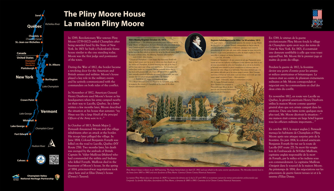
In 1789, Revolutionary War veteran Pliny Moore (1759-1822) settled Champlain after being awarded land by the State of New York. In 1801 he built a Federal-style frame house similar to the one standing today. Moore was the first judge and postmaster of the Town of Champlain.
During the War of 1812, the border became a revolving door for the American and British armies and militias. Moore’s house played a key role in the military events and he actively communicated with the commanders on both sides of the conflict.
In November of 1812, American General Henry Dearborn used Moore’s house as his headquarters when his army camped nearby on their way to Lacolle, Quebec.
In October of 1813, British Major J. Perreault threatened Pliny Moore and the village inhabitants after an attack at the border. His troops later pillaged the village. In June of 1814, Colonel Benjamin Forsyth was killed on the road to Lacolle (NY Rt. 276). Two months later, his death was avenged by the ambush of British Captain St. Valier Mailloux (Mahew) who had commanded the militia and Indians who killed Forsyth. Mailloux died in the basement of Moore’s house. In the spring of 1814, prisoner-of-war negotiations took place here and at Elias Dewey’s house (Dewey’s Tavern).
In the main image on the panel, Pliny Moore's house is shown in 1829, seven years after his death. The painting was made by a niece of Pliny's named Charlotte T. Moore. Pliny Moore's original house burned down on April 27, 1912 and was rebuilt to the same exterior specifications. The McLellan family lived in the house from 1883 to 1983 and were decedents of Pliny Moore.
GPS Location: 44.98679475750344, -73.44492804723856
During the War of 1812, the border became a revolving door for the American and British armies and militias. Moore’s house played a key role in the military events and he actively communicated with the commanders on both sides of the conflict.
In November of 1812, American General Henry Dearborn used Moore’s house as his headquarters when his army camped nearby on their way to Lacolle, Quebec.
In October of 1813, British Major J. Perreault threatened Pliny Moore and the village inhabitants after an attack at the border. His troops later pillaged the village. In June of 1814, Colonel Benjamin Forsyth was killed on the road to Lacolle (NY Rt. 276). Two months later, his death was avenged by the ambush of British Captain St. Valier Mailloux (Mahew) who had commanded the militia and Indians who killed Forsyth. Mailloux died in the basement of Moore’s house. In the spring of 1814, prisoner-of-war negotiations took place here and at Elias Dewey’s house (Dewey’s Tavern).
In the main image on the panel, Pliny Moore's house is shown in 1829, seven years after his death. The painting was made by a niece of Pliny's named Charlotte T. Moore. Pliny Moore's original house burned down on April 27, 1912 and was rebuilt to the same exterior specifications. The McLellan family lived in the house from 1883 to 1983 and were decedents of Pliny Moore.
GPS Location: 44.98679475750344, -73.44492804723856
Abolitionists Noadiah and Caroline Moore
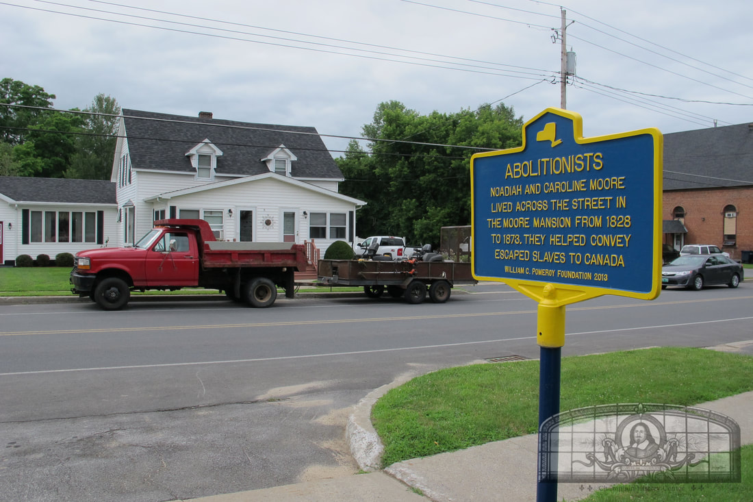
Church Street at St. Mary's Church
Noadiah Moore was the eldest child of Pliny Moore. He attended primary schools in St. Johns, Montreal and Plattsburgh and graduated from Middlebury College in 1808. He served in the War of 1812 as Barracks Master. He married Caroline Mattocks in 1814 and had five surviving children.
Noadiah first lived on Main Street adjacent to the old Village Hall building, and in 1822, he inherited his father’s land on Church Street. It is here he built his main residence. The house burned down in the great fire of 1873. The fire also burned down the adjacent school, Methodist Church and parsonage.
Noadiah owned several farms and sawmills and founded the Champlain Agricultural Works in 1820 near the upper bridge. The business made plows and farming equipment and was in business for about 90 years under several owners.
Noadiah was active in politics, Presbyterian Church affairs for 30 years, the Temperance movement and the Abolitionist movement. His property in Champlain was the last link in the Underground Railroad to Canada. Fellow church members Silas Hubbell, Orson Branch Ashmun and Lorenzo Kellogg were also active abolitionists in Champlain. Moore and Ashmun published the “Herald of Freedom” newspaper in 1844.
Noadiah was an advocate for the incorporation of the Village of Champlain but this did not happen until 15 years after his death. In 1873, the first village officers named “Moore Street” in his honor.
GPS Location: 44.98541301930818, -73.44872192218646
Noadiah first lived on Main Street adjacent to the old Village Hall building, and in 1822, he inherited his father’s land on Church Street. It is here he built his main residence. The house burned down in the great fire of 1873. The fire also burned down the adjacent school, Methodist Church and parsonage.
Noadiah owned several farms and sawmills and founded the Champlain Agricultural Works in 1820 near the upper bridge. The business made plows and farming equipment and was in business for about 90 years under several owners.
Noadiah was active in politics, Presbyterian Church affairs for 30 years, the Temperance movement and the Abolitionist movement. His property in Champlain was the last link in the Underground Railroad to Canada. Fellow church members Silas Hubbell, Orson Branch Ashmun and Lorenzo Kellogg were also active abolitionists in Champlain. Moore and Ashmun published the “Herald of Freedom” newspaper in 1844.
Noadiah was an advocate for the incorporation of the Village of Champlain but this did not happen until 15 years after his death. In 1873, the first village officers named “Moore Street” in his honor.
GPS Location: 44.98541301930818, -73.44872192218646
ABOLITIONISTS
NOADIAH AND CAROLINE MOORE
LIVED ACROSS THE STREET IN
THE MOORE MANSION FROM 1828
TO 1873. THEY HELPED CONVEY
ESCAPED SLAVES TO CANADA.
WILLIAM G. POMEROY FOUNDATION 2013
NOADIAH AND CAROLINE MOORE
LIVED ACROSS THE STREET IN
THE MOORE MANSION FROM 1828
TO 1873. THEY HELPED CONVEY
ESCAPED SLAVES TO CANADA.
WILLIAM G. POMEROY FOUNDATION 2013
Champlain Academy
Corner of Elm and Prospect Streets
In the early 1800s, citizens in the village and town of Champlain established an academy to promote education and spread “useful knowledge”. It was the second academy established in Clinton County, the first being in Plattsburgh.
Champlain's school history starts around 1795 with the establishment of several schools around town. Between 1807 and 1810, William Beaumont (1785-1853) taught at a school house on Oak Street in the Village of Champlain. He then left for St. Albans to study medicine and was a young doctor in Plattsburgh during the War of 1812. He would later become known as the "Father of Gastric Physiology" for his study of human digestion. Several institutions in the U.S. are named after him, including the William Beaumont Army Medical Center in Fort Bliss, Texas. Plattsburgh State's "Beaumont Hall" is a local building.
In 1833, land on the Moore property on Elm Street was sold to a local group of citizens for the establishment of an academy. Building funds were raised through fundraisers such as dinners on the island ("Island Park" in the Great Chazy River). Starting in 1838, the school building was slowly erected at the corner of Elm and Prospect streets. When it was finished, it was 40x80ft in size and three stories high. It had a library donated by the Champlain Society Library as well as rooms for boarding students. The academy was incorporated by the NYS Regents in August of 1842. Its first trustees were Silas Hubbell, Noadiah Moore, Nathan Webb, Jabez Fitch, James M. Burroughs, Julius C. Hubbell, Robert Stetson, Lovel Dunning, Joel Savage, Daniel D.T. Moore, Dwight C. Hitchcock and Ezekiel Brisbin. The building stood for almost 50 years and burned down in January of 1887. No photos have been found of this building.
By February of 1889, a new Champlain Academy building had been erected. This building was 2 1/2 stories tall, 40x76ft in size and had a bell tower which gave it a distinctive look. At the time, the building size was viewed by some citizens as being too large because only a small percentage of the school age children in town attended school, but 15 years later, in 1905, a back addition was added by architect Hugh McLellan (1874-1963). In the 1900s, the Champlain Board of Education converted the academy to a high school. People today may have close relatives who went to this school. The building stood for 51 years and burned down on December 16, 1940. Hugh McLellan was also the architect of the new school built in 1941 across the street (which still stands, shown previously).
GPS Location: 44.98708133318049, -73.4437494533047
Champlain's school history starts around 1795 with the establishment of several schools around town. Between 1807 and 1810, William Beaumont (1785-1853) taught at a school house on Oak Street in the Village of Champlain. He then left for St. Albans to study medicine and was a young doctor in Plattsburgh during the War of 1812. He would later become known as the "Father of Gastric Physiology" for his study of human digestion. Several institutions in the U.S. are named after him, including the William Beaumont Army Medical Center in Fort Bliss, Texas. Plattsburgh State's "Beaumont Hall" is a local building.
In 1833, land on the Moore property on Elm Street was sold to a local group of citizens for the establishment of an academy. Building funds were raised through fundraisers such as dinners on the island ("Island Park" in the Great Chazy River). Starting in 1838, the school building was slowly erected at the corner of Elm and Prospect streets. When it was finished, it was 40x80ft in size and three stories high. It had a library donated by the Champlain Society Library as well as rooms for boarding students. The academy was incorporated by the NYS Regents in August of 1842. Its first trustees were Silas Hubbell, Noadiah Moore, Nathan Webb, Jabez Fitch, James M. Burroughs, Julius C. Hubbell, Robert Stetson, Lovel Dunning, Joel Savage, Daniel D.T. Moore, Dwight C. Hitchcock and Ezekiel Brisbin. The building stood for almost 50 years and burned down in January of 1887. No photos have been found of this building.
By February of 1889, a new Champlain Academy building had been erected. This building was 2 1/2 stories tall, 40x76ft in size and had a bell tower which gave it a distinctive look. At the time, the building size was viewed by some citizens as being too large because only a small percentage of the school age children in town attended school, but 15 years later, in 1905, a back addition was added by architect Hugh McLellan (1874-1963). In the 1900s, the Champlain Board of Education converted the academy to a high school. People today may have close relatives who went to this school. The building stood for 51 years and burned down on December 16, 1940. Hugh McLellan was also the architect of the new school built in 1941 across the street (which still stands, shown previously).
GPS Location: 44.98708133318049, -73.4437494533047
The Averill and Clark Boat Yard
Boat Ramp
River Street
The Town of Champlain has a rich history related to boat building on the Great Chazy River. In the mid-1830’s, brothers Freeman and Bartlett Nye of Champlain operated the schooner “Champlain.” In 1839, they built the schooner “Gen. Scott” and for 20 years it was used to transport commodities to St. Johns, Quebec and Whitehall, N.Y. After the opening of the Champlain Canal in Whitehall and the Chambly Canal in Quebec, sloops and schooners began to be replaced by canal boats. In the 1850’s, Pliny Moore Jr., Royal Moore and Timothy Hoyle built and owned some of Champlain’s first canal boats.
By the mid-1800’s, 20 boats had been built in Champlain which made the town the second largest shipbuilding center on Lake Champlain. Then in 1879, the “Kellogg & Averill” (later “Averill & Clark”) boat yard was established by industrialist James Averill Jr. and his partners. This boat yard was located on the former Nye land at the end of River Street. For 30 years, the Averill boat yard built canal boats, barges, houseboats, yachts and even an automobile ferry for Chazy Landing. The Allards built several canal boats in a nearby yard.
The canal boat industry had a major impact on the growth of the village and town of Champlain for 100 years. Boat building employed carpenters, dock hands and ship captains. The timber, paper, iron and farming industries used canal boats to ship their products to markets in Montreal, Troy and as far away as New York City.
The era of the canal boat peaked in the early 1900’s. Canal boats had ceased operation on the Great Chazy River by 1919.
GPS Location: 44.98485581873992, -73.4428912498401
By the mid-1800’s, 20 boats had been built in Champlain which made the town the second largest shipbuilding center on Lake Champlain. Then in 1879, the “Kellogg & Averill” (later “Averill & Clark”) boat yard was established by industrialist James Averill Jr. and his partners. This boat yard was located on the former Nye land at the end of River Street. For 30 years, the Averill boat yard built canal boats, barges, houseboats, yachts and even an automobile ferry for Chazy Landing. The Allards built several canal boats in a nearby yard.
The canal boat industry had a major impact on the growth of the village and town of Champlain for 100 years. Boat building employed carpenters, dock hands and ship captains. The timber, paper, iron and farming industries used canal boats to ship their products to markets in Montreal, Troy and as far away as New York City.
The era of the canal boat peaked in the early 1900’s. Canal boats had ceased operation on the Great Chazy River by 1919.
GPS Location: 44.98485581873992, -73.4428912498401
Bill Earl Park
Boat Ramp
River Street
The land surrounding River Street has been used for many different purposes over the past 200 years. Prior to 1829, it was a lush riverside pasture for Judge Pliny Moore’s cows. By the mid-1800’s, the riverbank was being used for commercial purpose. A store, marble shop, warehouse and boat yard were built here. By the early 1900’s, many houses lined River Street but only a few remain today due to past floods.
In the late 1800’s, a sawmill was located at the end of River Street and was owned by John Earl, father of Bill. Bill worked here when he was young and later hauled sand from Lake Champlain to the Sheridan Iron Works in a boat he owned. Around 1906, Bill operated a small bicycle repair shop near his house on the riverbank and Champlain’s youth often had their bikes repaired here for free. He rented pleasure boats and owned a small paddlewheel that cruised the river. Bill was known to take children to see Lake Champlain’s islands.
Bill Earl died on May 15, 1943 at the age of 76 and his funeral was held in the nearby funeral home. Hundreds of children passed his casket and paid their respects. He was buried in Glenwood Cemetery with his family members. A lengthy obituary was written by the “Friends of Bill” and recalled many fond memories of him. This park is named in honor of Bill Earl because of his years of dedication to the children of Champlain.
GPS Location: 44.98485581873992, -73.4428912498401
In the late 1800’s, a sawmill was located at the end of River Street and was owned by John Earl, father of Bill. Bill worked here when he was young and later hauled sand from Lake Champlain to the Sheridan Iron Works in a boat he owned. Around 1906, Bill operated a small bicycle repair shop near his house on the riverbank and Champlain’s youth often had their bikes repaired here for free. He rented pleasure boats and owned a small paddlewheel that cruised the river. Bill was known to take children to see Lake Champlain’s islands.
Bill Earl died on May 15, 1943 at the age of 76 and his funeral was held in the nearby funeral home. Hundreds of children passed his casket and paid their respects. He was buried in Glenwood Cemetery with his family members. A lengthy obituary was written by the “Friends of Bill” and recalled many fond memories of him. This park is named in honor of Bill Earl because of his years of dedication to the children of Champlain.
GPS Location: 44.98485581873992, -73.4428912498401
The Railroad in Champlain
Butternut Street
CHAMPLAIN
THE NORTHERN RAILROAD WAS
COMPLETED IN THE YEAR 1850.
THE FIRST TRAIN RAN OVER
THE ENTIRE LINE; OGDENSBURG
TO ROUSES POINT IN THE AUTUMN
2025 BY WOODMEN LIFE CHAPTER 462
THE NORTHERN RAILROAD WAS
COMPLETED IN THE YEAR 1850.
THE FIRST TRAIN RAN OVER
THE ENTIRE LINE; OGDENSBURG
TO ROUSES POINT IN THE AUTUMN
2025 BY WOODMEN LIFE CHAPTER 462
GPS Location: 44.988411840198424, -73.44275443295801
Samuel de Champlain Monument
St. Mary's Church
Church Street
|
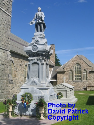
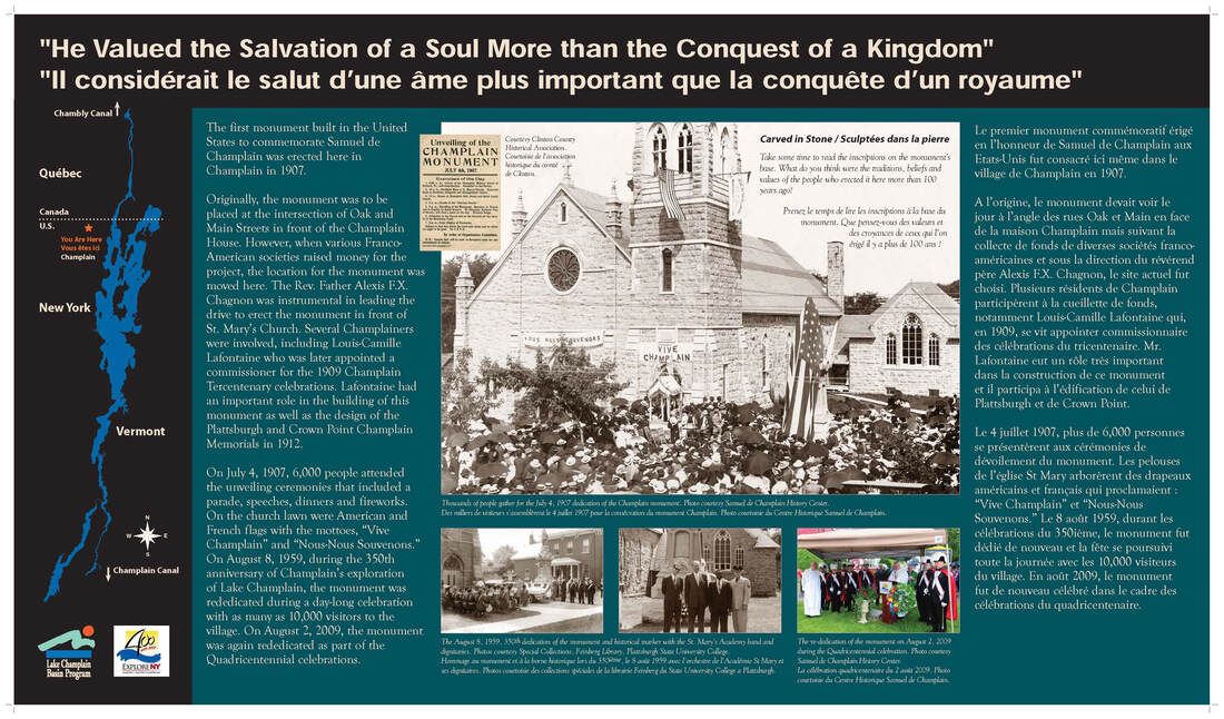
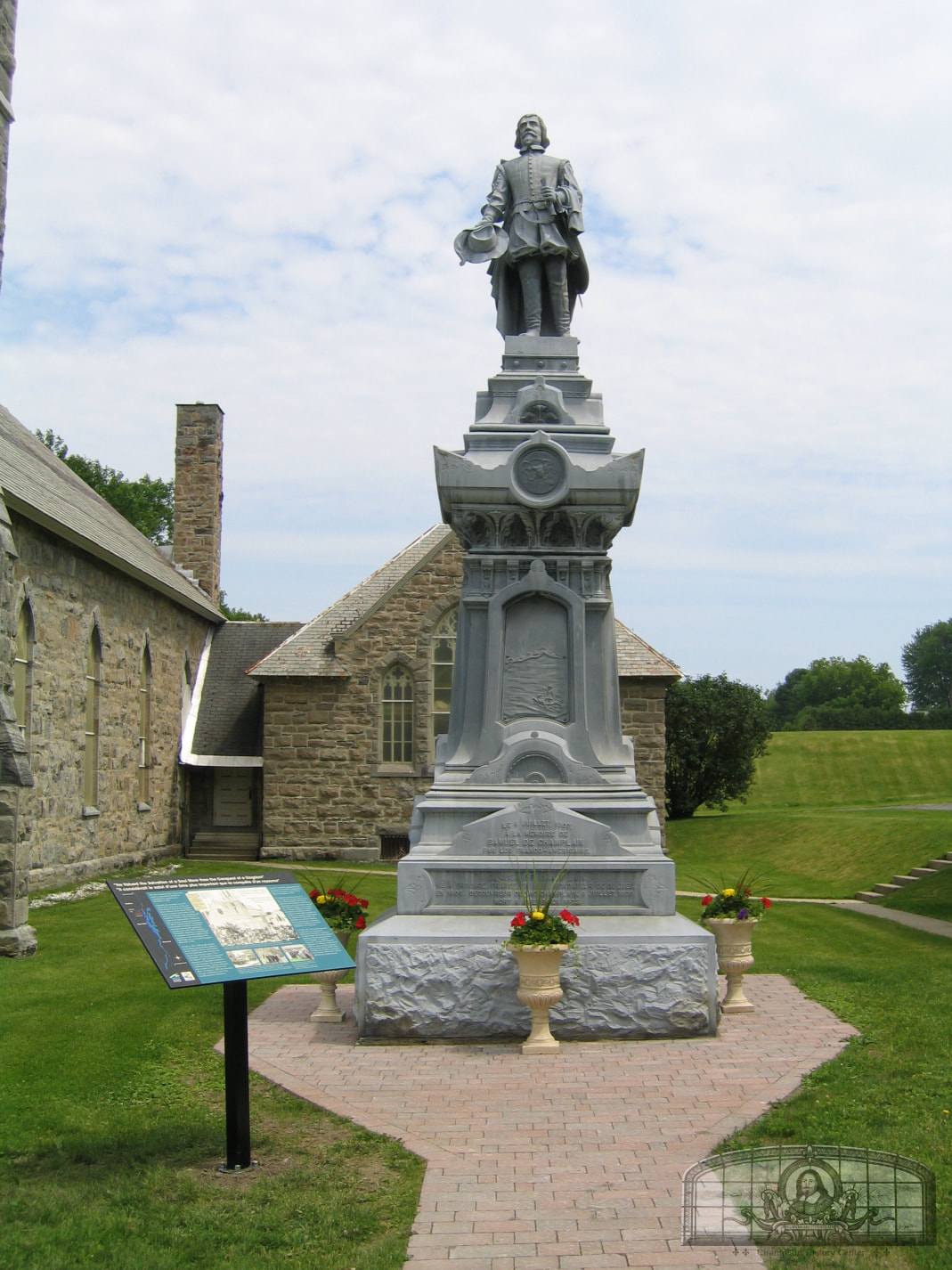
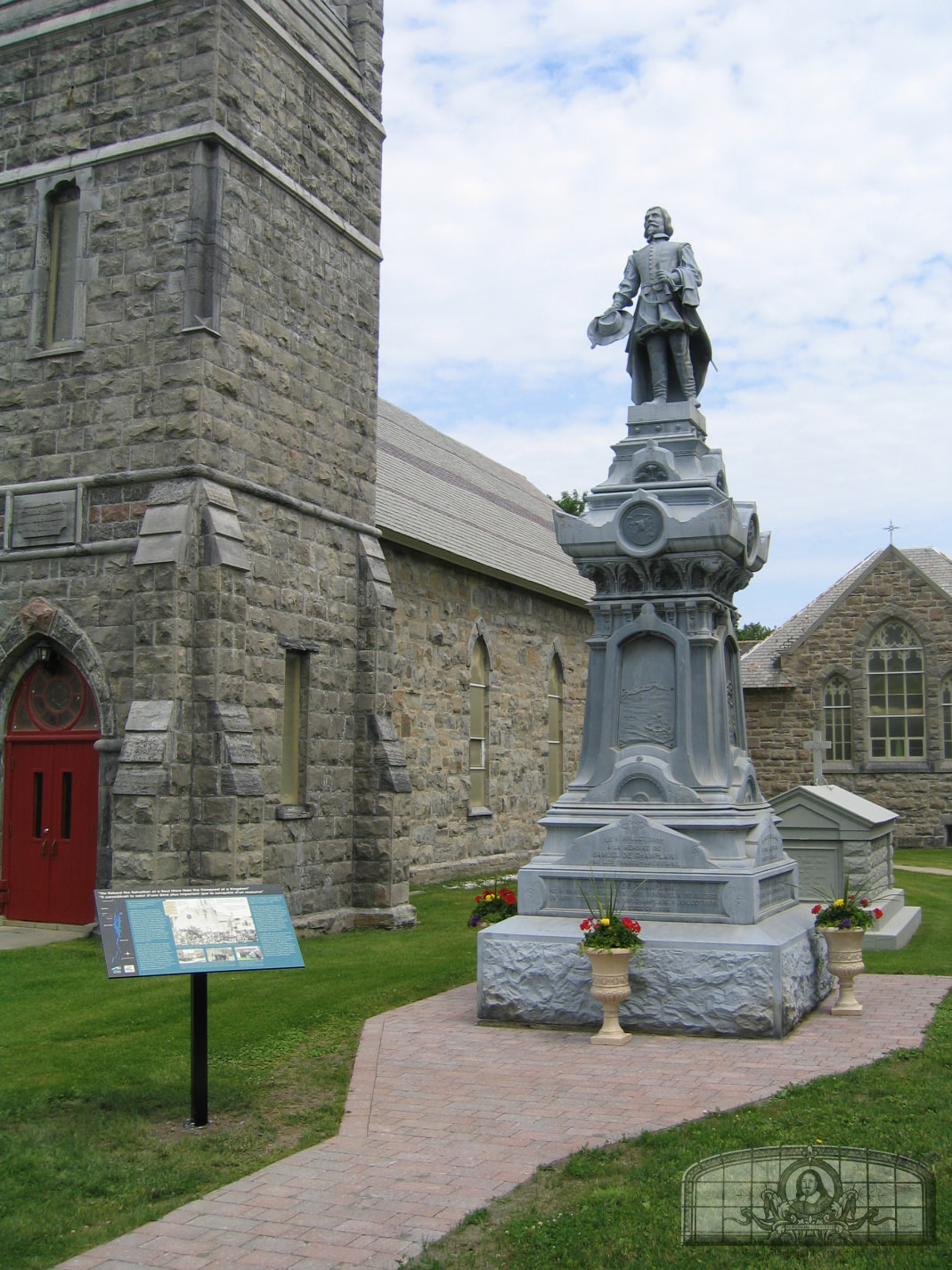
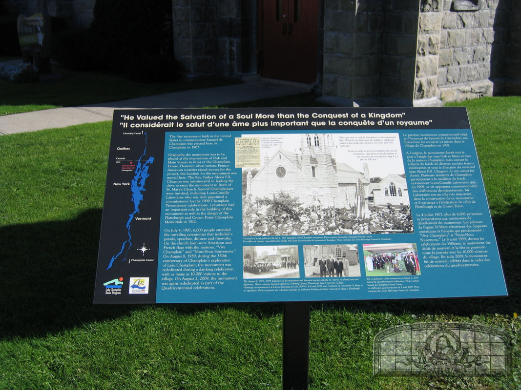
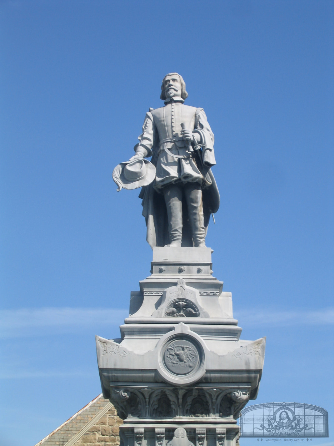
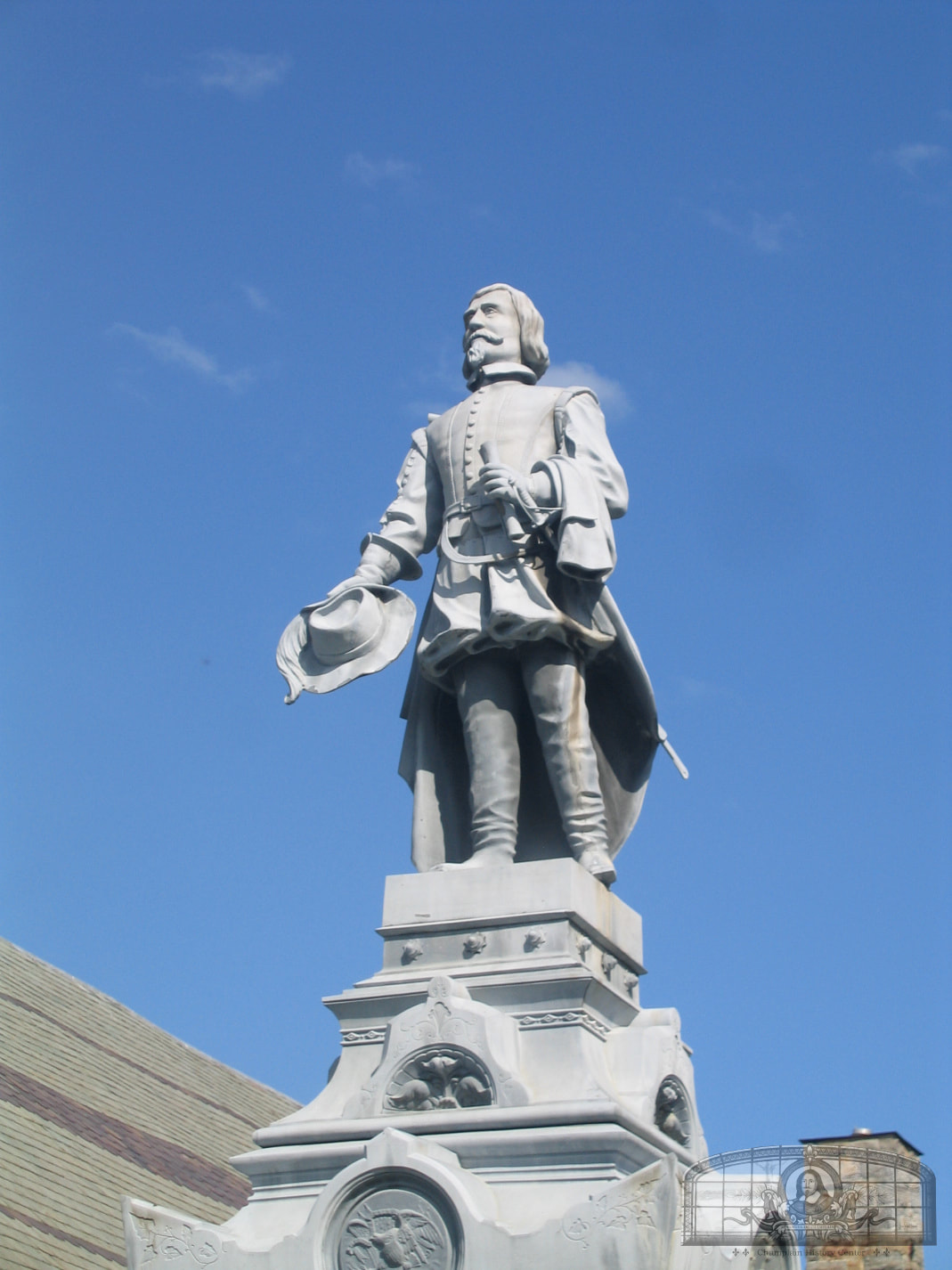
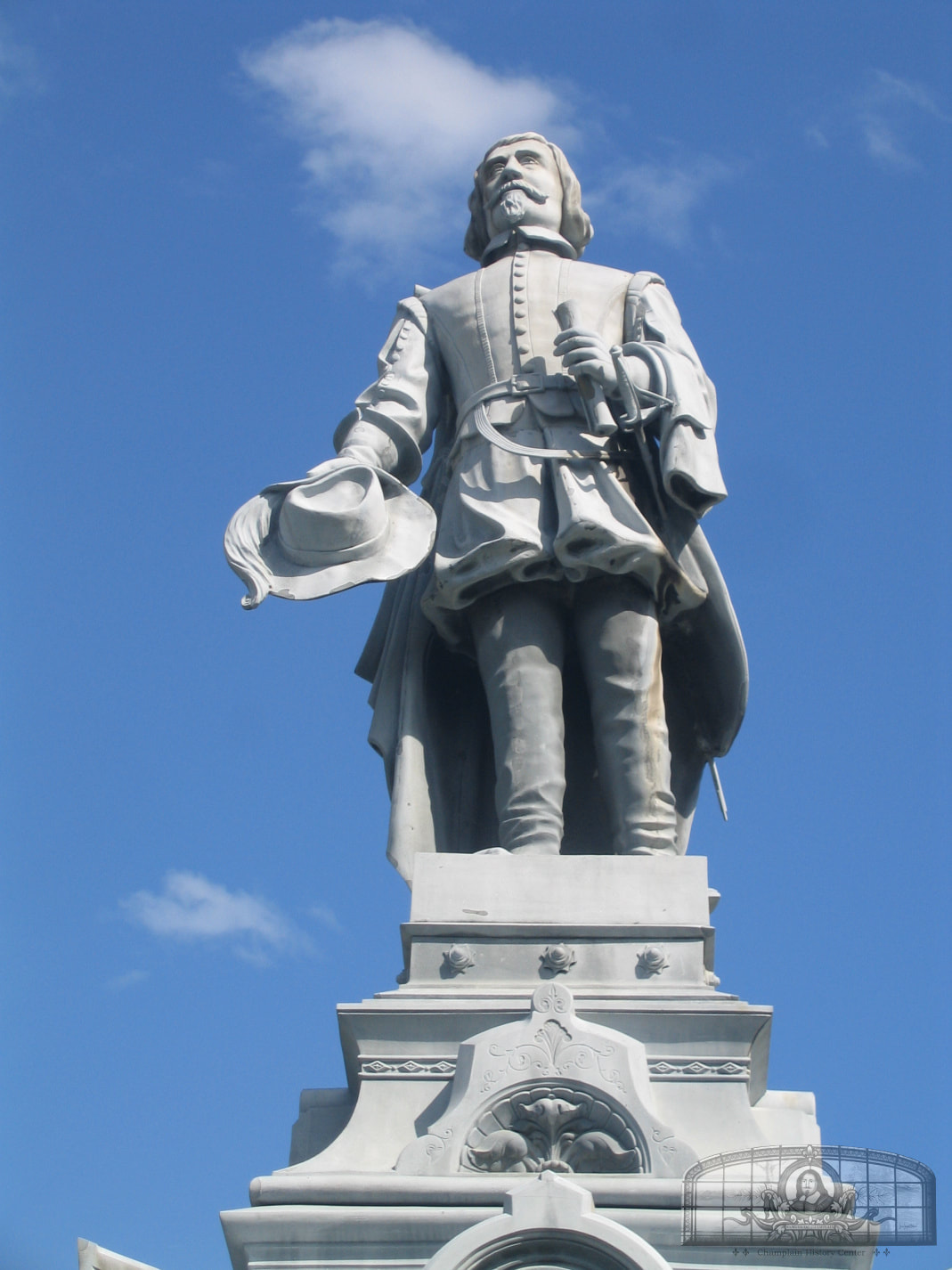
The first monument built in the United States to commemorate Samuel de Champlain was erected in Champlain in 1907.
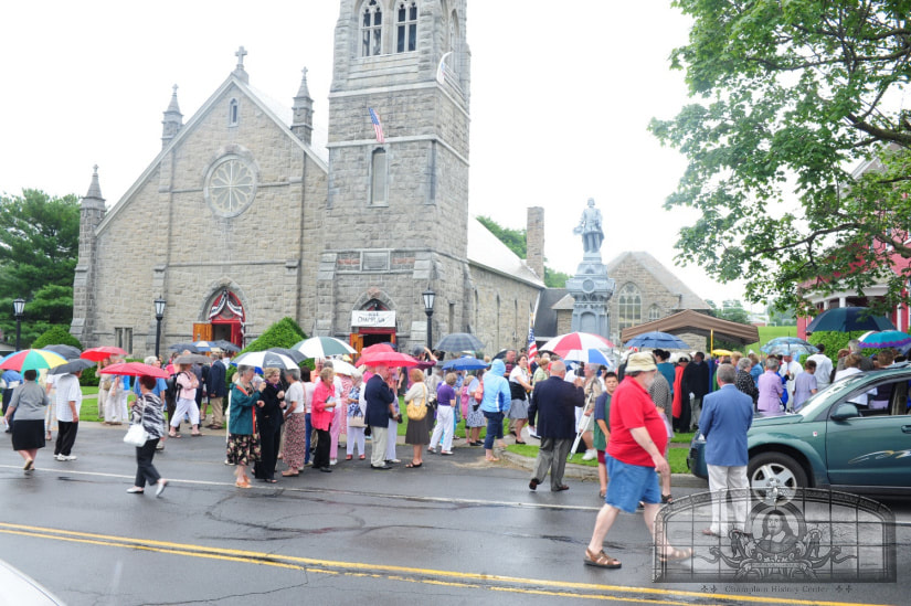
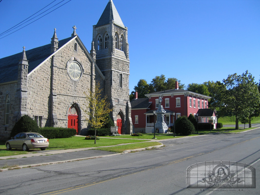
Originally, the monument was to be placed at the intersection of Oak and Main Streets in front of the Champlain House. However, when various Franco-American societies raised money for the project, the location for the monument was moved here to St. Mary’s Church. The Rev. Father Alexis F.X. Chagnon was instrumental in leading the drive to erect the monument at the church. Several Champlainers were part of this project and included Louis-Camille Lafontaine who was later appointed a commissioner for the 1909 Champlain Tercentenary celebrations. Lafontaine had an important role in the building of this monument as well as the design of the Plattsburgh and Crown Point Champlain Memorials in 1912. On July 4, 1907, 6,000 people attended the monument unveiling ceremonies that included a parade, speeches, dinners and fireworks. On the church lawn were American and French flags with the mottoes, “Vive Champlain” and “Nous-Nous Souvenons”. On August 8, 1959, during the 350th anniversary of Champlain’s exploration of Lake Champlain, the monument was re-dedicated during a day long celebration with as many as 10,000 visitors to the village. On August 2, 2009, the monument was again re-dedicated as part of the Quadricentennial celebrations. GPS Location: 44.985186287451, -73.44873787069534 |
LE 4 JUILLET, 1907. À LA MÉMOIRE DE
SAMUEL DE CHAMPLAIN
PAR LES FRANCO-AMÉRICANS.
SAMUEL DE CHAMPLAIN,
NÉ À BROUAGE, FRANCE, EN 1567, FONDATEUR DE QUÉBEC, EN 1608.
DÉCOUVREUR DU LAC CHAMPLAIN, 6 JUILLET, 1609.
MORT À QUEBEC AN 1635.
HE VALUED THE SALVATION OF A SOUL MORE THAN THE
CONQUEST OF A KINGDOM.
BEHOLD: A FERVENT CHRISTIAN; AN INTREPID NAVIGATOR;
A MAN OF LETTERS AND THE DISCOVERER OF THE GEM
OF THE LAKES OF AMERICA.
LE SALUT D’UNE ÂME VAUT PLUS QUE LA CONQUÊTE D’UN ROYAUME.
SA MÉMOIRE EST UNE INSPIRATION QUI NOUS PORTE VERS LE VRAI,
LE BIEN ET LE BEAU!
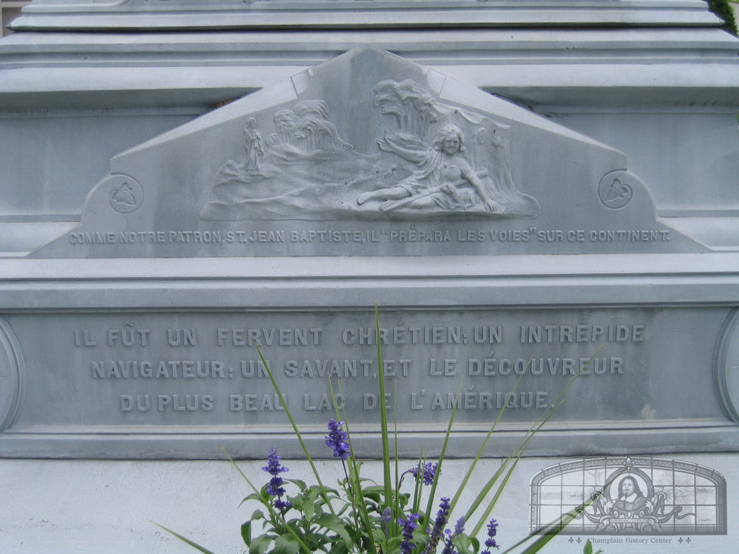
COMME NOTRE PATRON, ST. JEAN BAPTISTE;
IL “PRÉPARA LES VOIES” SUR CE CONTINENT.
IL FÛT UN FERVENT CHRÉTIEN: UN INTREPIDE NAVIGATEUR:
UN SAVANT, ET LE DÉCOUVREUR DU PLUS BEAU LAC DE L’AMÉRIQUE.
SAMUEL DE CHAMPLAIN
PAR LES FRANCO-AMÉRICANS.
SAMUEL DE CHAMPLAIN,
NÉ À BROUAGE, FRANCE, EN 1567, FONDATEUR DE QUÉBEC, EN 1608.
DÉCOUVREUR DU LAC CHAMPLAIN, 6 JUILLET, 1609.
MORT À QUEBEC AN 1635.
HE VALUED THE SALVATION OF A SOUL MORE THAN THE
CONQUEST OF A KINGDOM.
BEHOLD: A FERVENT CHRISTIAN; AN INTREPID NAVIGATOR;
A MAN OF LETTERS AND THE DISCOVERER OF THE GEM
OF THE LAKES OF AMERICA.
LE SALUT D’UNE ÂME VAUT PLUS QUE LA CONQUÊTE D’UN ROYAUME.
SA MÉMOIRE EST UNE INSPIRATION QUI NOUS PORTE VERS LE VRAI,
LE BIEN ET LE BEAU!
COMME NOTRE PATRON, ST. JEAN BAPTISTE;
IL “PRÉPARA LES VOIES” SUR CE CONTINENT.
IL FÛT UN FERVENT CHRÉTIEN: UN INTREPIDE NAVIGATEUR:
UN SAVANT, ET LE DÉCOUVREUR DU PLUS BEAU LAC DE L’AMÉRIQUE.
The Samuel de Champlain Monument at St. Mary’s Church
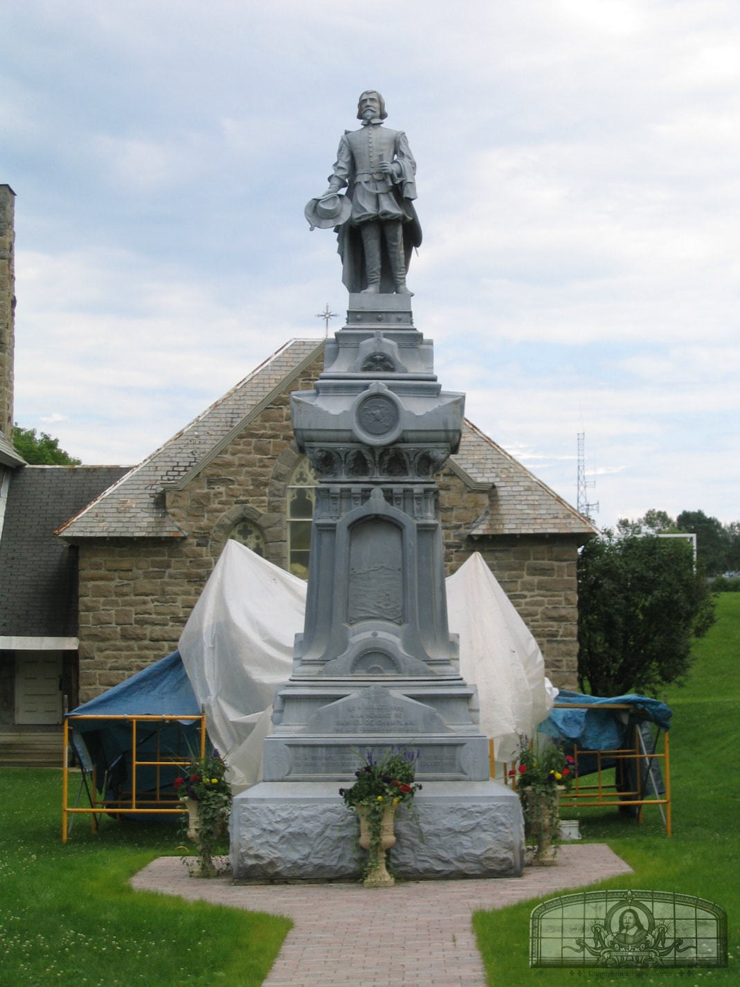
The first monument in the United States built to commemorate Samuel de Champlain was erected at St. Mary’s Church in Champlain, New York. Originally, it was to be built on Main Street in the village square (at the Elm St. and Main St. intersection) but when French societies raised funds for the erection of the monument, it was erected on the lawn of St. Mary’s Church.
Future Tercentenary Commissioner Louis-Camille LaFontaine, a lifelong resident of Champlain, was a member of the committee who worked to build this monument prior to 1907. A few years later, he was a member of the 1909 New York Tercentenary Commission that worked to build the Champlain Memorials at Crown Point and Plattsburgh, both of which were completed in 1912. LaFontaine was instrumental in much of the wording on these monuments as well as the design of the sculptures and the Coat of Arms.
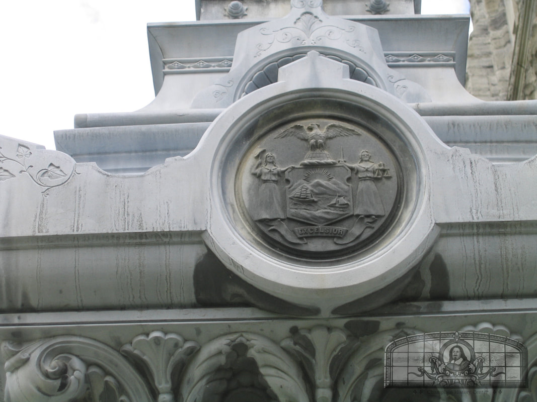
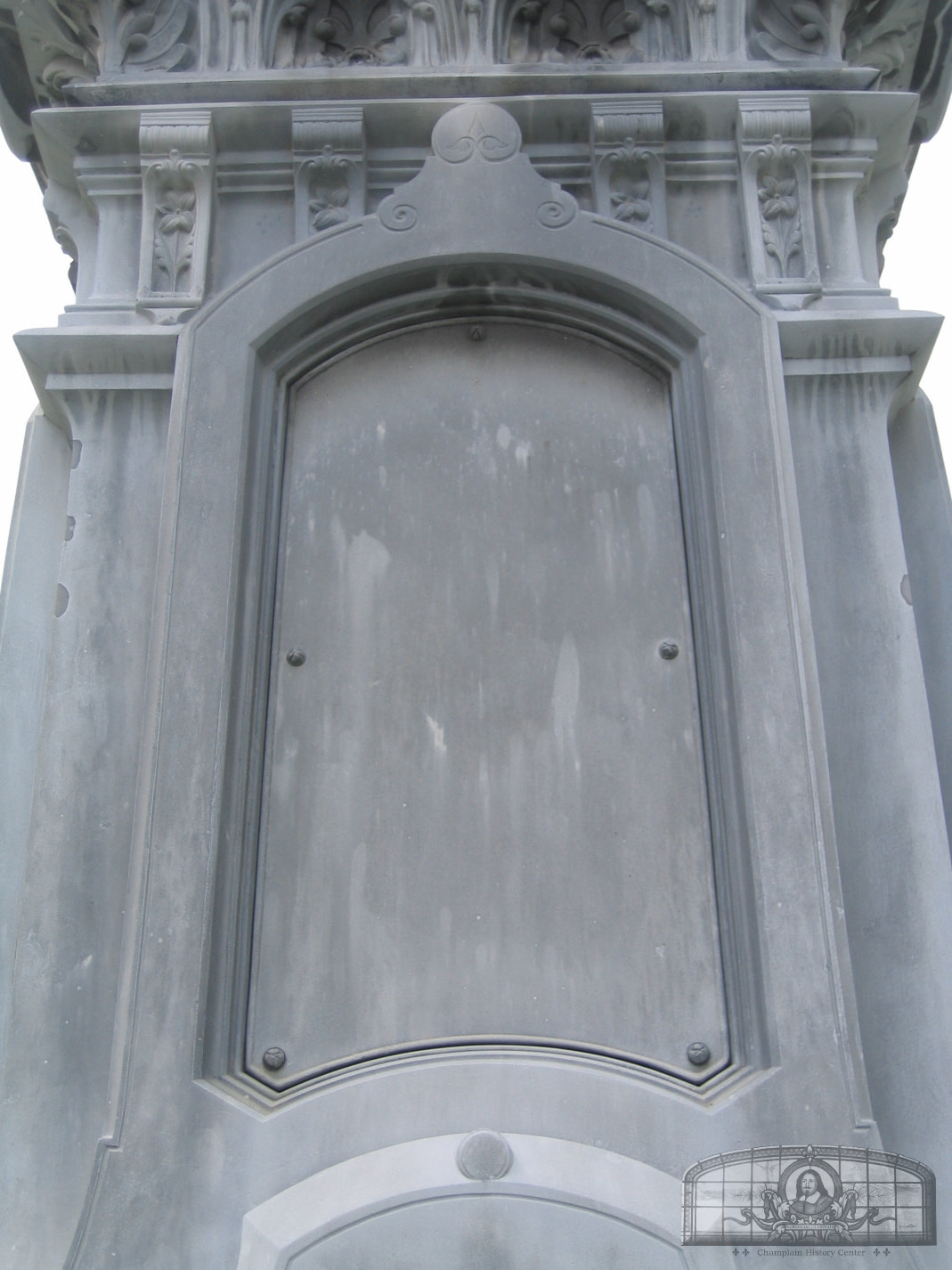
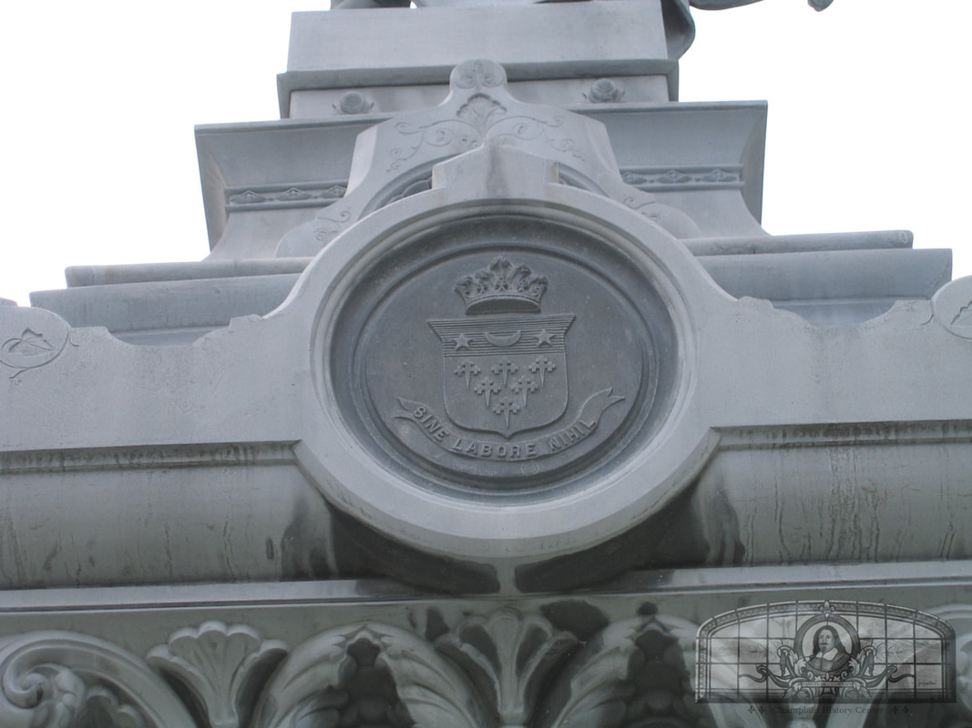
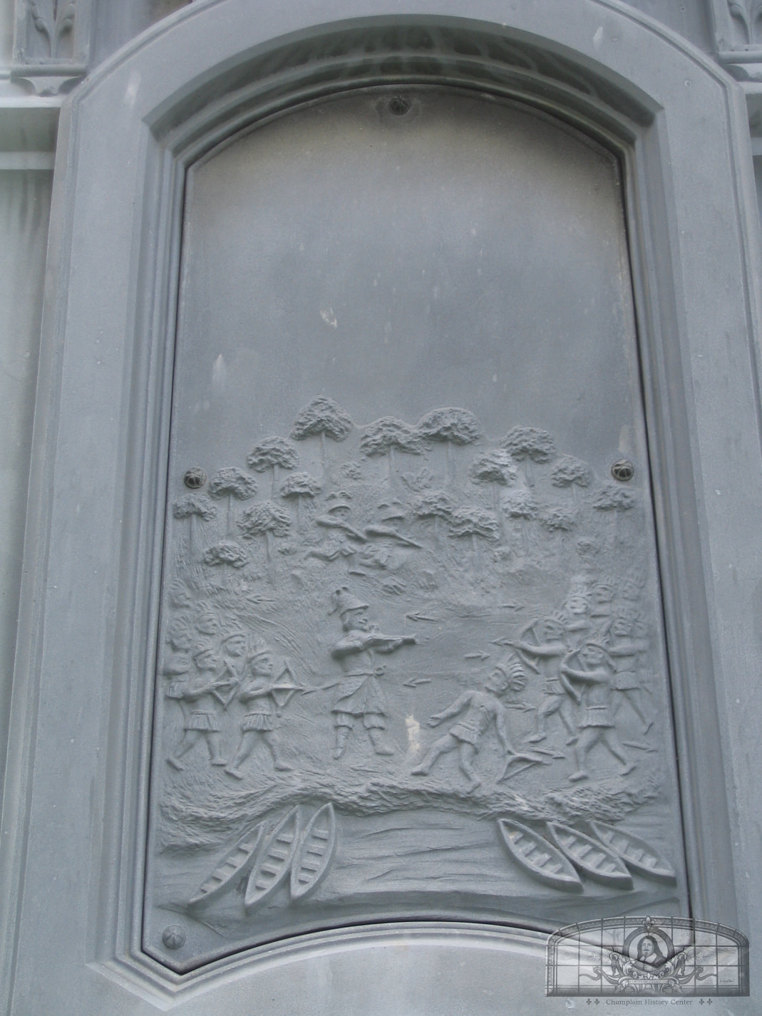
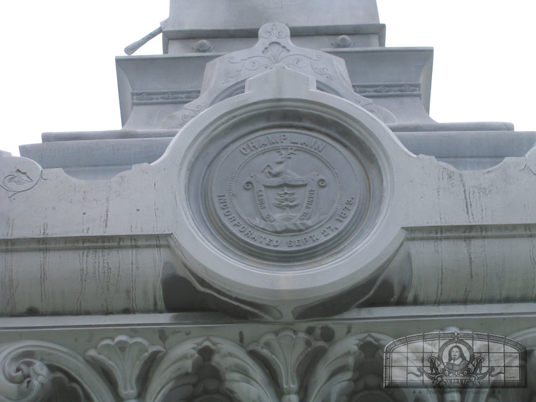
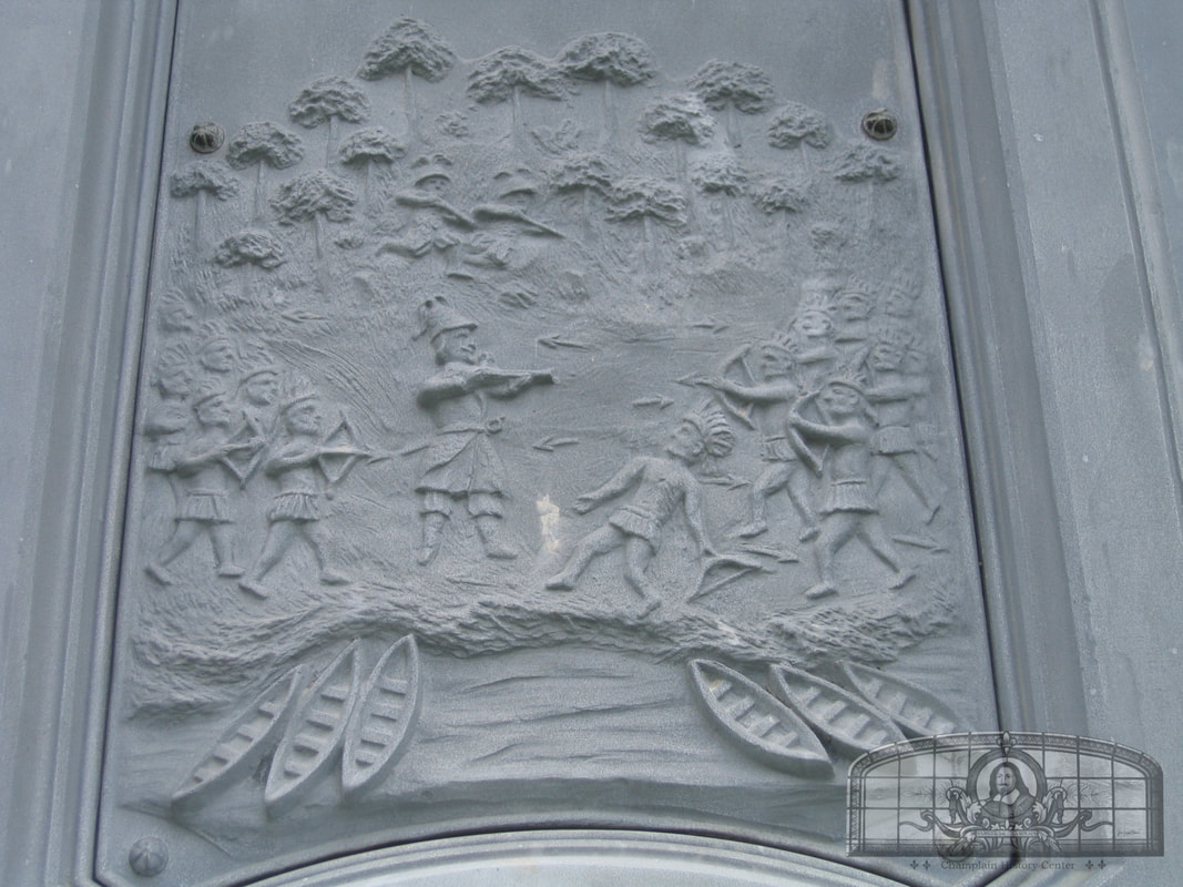
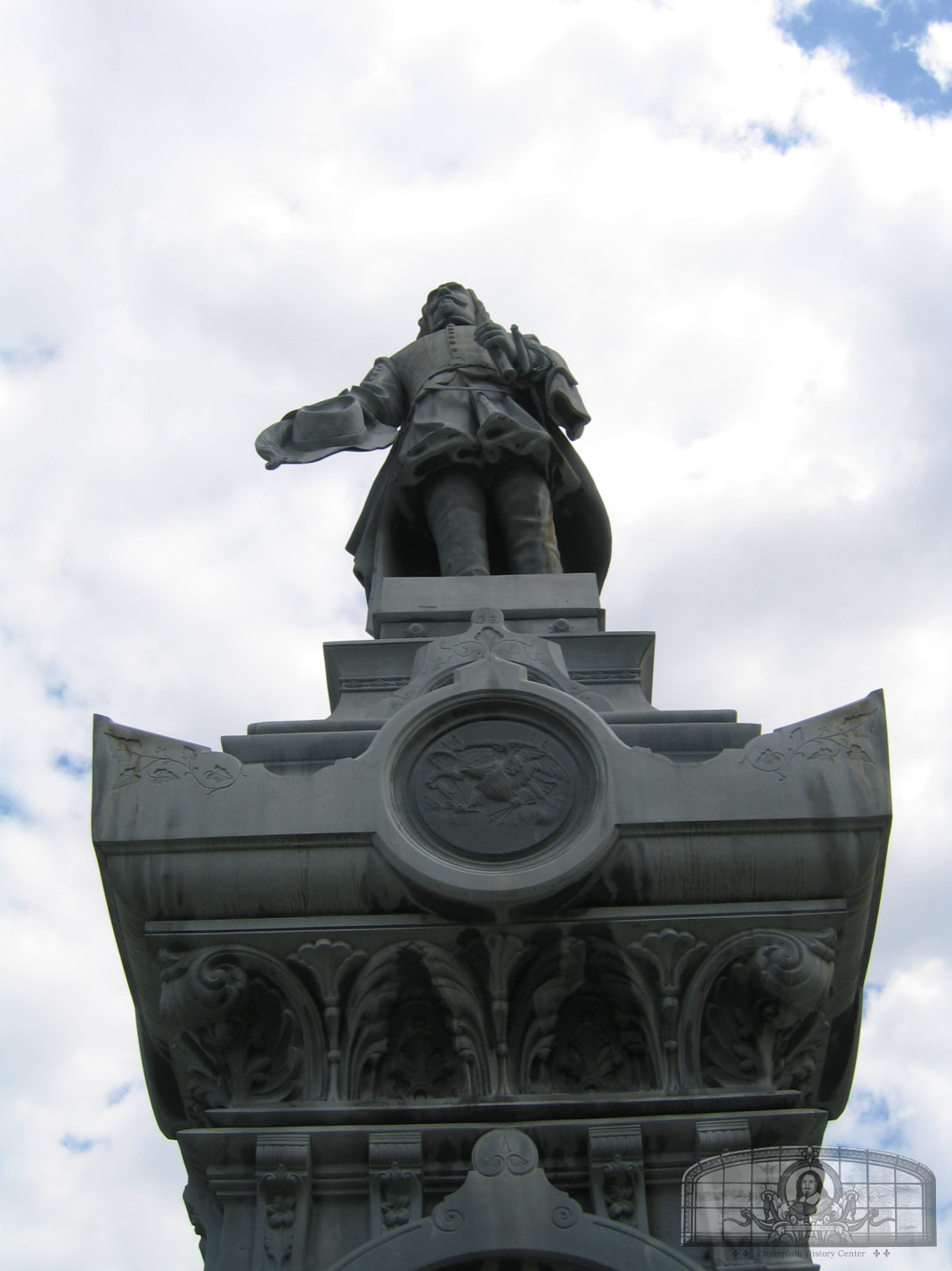
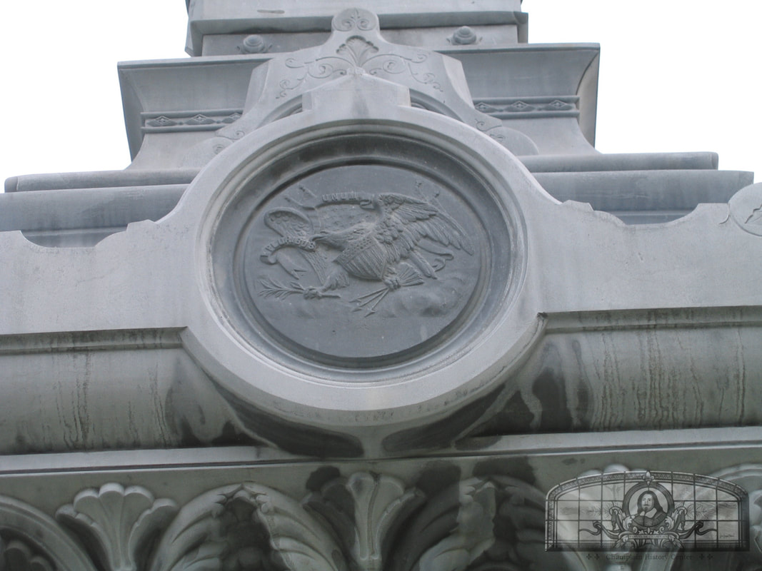
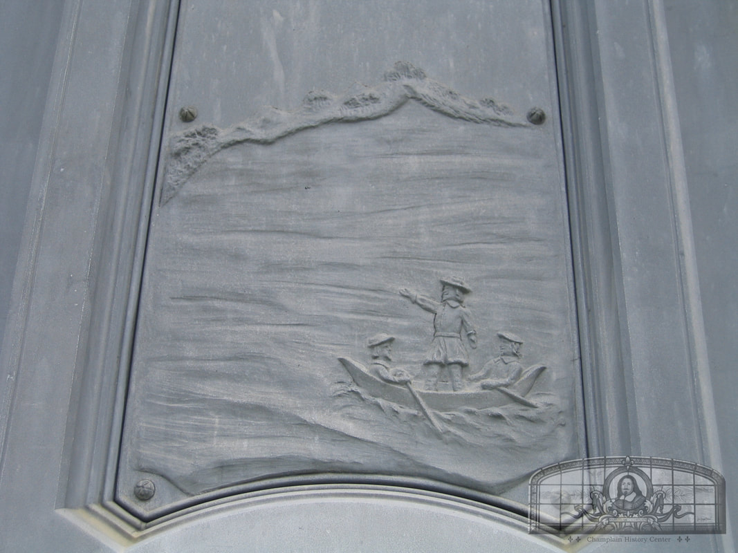
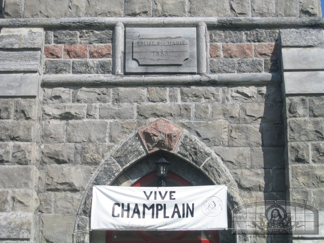
On July 4, 1907, the Champlain monument was dedicated. About 6,000 people witnessed the unveiling, with hundreds coming from as far away as Plattsburgh. A newspaper noted that the following account: “the entire village was prettily decorated. Nearly every house and building displayed American flags and the tri-color of France was displayed, an appropriate memorial to the nationality of the distinguished explorer. Over the bridges in the center of the village were too large arches, bearing the inscription, “Welcome”. The Catholic Church, on the lawn of which the monument is placed, was prettily decorated, American and French flags being hung over the entrance, with the mottoes, “Vive Champlain” [Live Champlain] and “Nous-Nous Souvenons” ….. The pedestal is surmounted by a statue of the explorer, six feet and six inches in height, and represents him at the instant of the discovery of the lake, the expression and attitude being excellent. The base of the pedestal is 7½ feet square and the total height twenty two feet and one inch. One of the panels on the pedestal represents Champlain in an Indian canoe, his eyes fixed upon a distant shore toward which his two companions are paddling. Another shows a landscape with a short point of wooded land projecting into the lake and another a representation of an old print showing the battle fought by the explorer against the Iroquois, aided by friendly Indians. On the cap are the coats of arms of the United States, the State of New York and the Clinton family, after which the county is named, and the seal of the Village of Champlain. / The credit of securing the monument is largely due to the Rev. Father Chagnon, pastor of the Champlain Church, to whose untiring efforts much of the success of the undertaking is to be attributed. The committee having the erection of the monument in charge were Dr. A. Charbonneau, Keeseville, president; Oliver Lafontaine, Champlain; the Rev. Father E. C. Laramee, Redford; L. C. Lafontaine, Champlain, treasurer. These gentlemen also did much to make the undertaking a success. The Rev. Father Valois, Assistant to Father Chagnon, had charge of the celebration and the reception of visitors.”
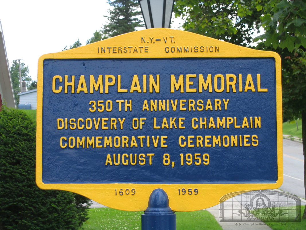
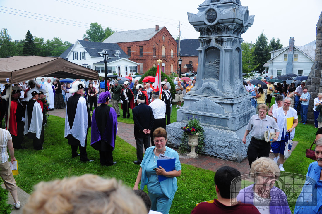
On August 8, 1959, the 350th anniversary of Champlain’s exploration of Lake Champlain was celebrated. The monument was re-dedicated during a day long celebration with as many as 10,000 visitors to the village. The new post office as well as Jehudi Ashmun plaque was also dedicated.
In August of 2009, the monument was re-dedicated for the 400th anniversary of Champlain's exploration of Lake Champlain. This was called the Quadricentennial.
The first monument in the United States built to commemorate Samuel de Champlain was erected at St. Mary’s Church in Champlain, New York. Originally, it was to be built on Main Street in the village square (at the Elm St. and Main St. intersection) but when French societies raised funds for the erection of the monument, it was erected on the lawn of St. Mary’s Church.
Future Tercentenary Commissioner Louis-Camille LaFontaine, a lifelong resident of Champlain, was a member of the committee who worked to build this monument prior to 1907. A few years later, he was a member of the 1909 New York Tercentenary Commission that worked to build the Champlain Memorials at Crown Point and Plattsburgh, both of which were completed in 1912. LaFontaine was instrumental in much of the wording on these monuments as well as the design of the sculptures and the Coat of Arms.
On July 4, 1907, the Champlain monument was dedicated. About 6,000 people witnessed the unveiling, with hundreds coming from as far away as Plattsburgh. A newspaper noted that the following account: “the entire village was prettily decorated. Nearly every house and building displayed American flags and the tri-color of France was displayed, an appropriate memorial to the nationality of the distinguished explorer. Over the bridges in the center of the village were too large arches, bearing the inscription, “Welcome”. The Catholic Church, on the lawn of which the monument is placed, was prettily decorated, American and French flags being hung over the entrance, with the mottoes, “Vive Champlain” [Live Champlain] and “Nous-Nous Souvenons” ….. The pedestal is surmounted by a statue of the explorer, six feet and six inches in height, and represents him at the instant of the discovery of the lake, the expression and attitude being excellent. The base of the pedestal is 7½ feet square and the total height twenty two feet and one inch. One of the panels on the pedestal represents Champlain in an Indian canoe, his eyes fixed upon a distant shore toward which his two companions are paddling. Another shows a landscape with a short point of wooded land projecting into the lake and another a representation of an old print showing the battle fought by the explorer against the Iroquois, aided by friendly Indians. On the cap are the coats of arms of the United States, the State of New York and the Clinton family, after which the county is named, and the seal of the Village of Champlain. / The credit of securing the monument is largely due to the Rev. Father Chagnon, pastor of the Champlain Church, to whose untiring efforts much of the success of the undertaking is to be attributed. The committee having the erection of the monument in charge were Dr. A. Charbonneau, Keeseville, president; Oliver Lafontaine, Champlain; the Rev. Father E. C. Laramee, Redford; L. C. Lafontaine, Champlain, treasurer. These gentlemen also did much to make the undertaking a success. The Rev. Father Valois, Assistant to Father Chagnon, had charge of the celebration and the reception of visitors.”
On August 8, 1959, the 350th anniversary of Champlain’s exploration of Lake Champlain was celebrated. The monument was re-dedicated during a day long celebration with as many as 10,000 visitors to the village. The new post office as well as Jehudi Ashmun plaque was also dedicated.
In August of 2009, the monument was re-dedicated for the 400th anniversary of Champlain's exploration of Lake Champlain. This was called the Quadricentennial.
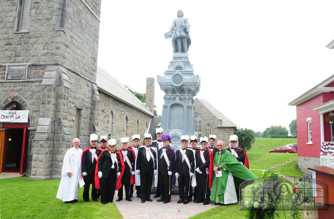
Rededication of the Champlain monument during the Quadricentennial celebrations in August of 2009.
St. Mary's Academy and Convent
Main Street
cccccccccccccccccccccccccccccccccccccc
wip
GPS Location: 44.98510172022329, -73.44526856881183
wip
GPS Location: 44.98510172022329, -73.44526856881183
Paquette Community Park
Main Street
Paquette Park is named after William (1890-1965) and Lawrence Paquette (1925-1992). The father and son were village and town of Champlain clerks for a total of 50 years. The park and plaque were dedicated during Champlain Village's 100 year celebration in August of 1973. The park was created where several Main Street buildings had burned down in the mid-1960s. It expanded again when a brick building near the bridge was bought out by FEMA in the early 2000s. In the mid 2010s, two additional plaques and their stones were moved to the park. The first was the Champlain settlers plaque at the old village and town hall on Main Street which was dedicated in August of 1938 and the second was the Jehudi Ashmun plaque at the former elementary school that had been dedicated in August of 1959.
GPS Location: 44.986346347733, -73.44588447794908
Grange Hall Park
Church and Cedar Streets
The Champlain Grange #883 in the village was founded in 1899. Members opened a new hall on January 22, 1925 at the corner of Church and Cedar Streets. Many community events were held at Grange Hall in the 1920s, '30s and '40s. By 1971, the hall building hosted Margaret Senecal's variety shop.
GPS Location: 44.9860550728021, -73.44829777599111
Town of Champlain
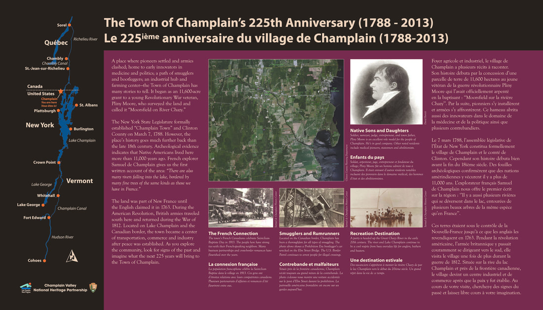
During the Revolutionary War, the State of New York raised militias by offering bounties of land to soldiers who enlisted. A young soldier named Pliny Moore, who lived in Kinderhook, N.Y., was awarded a 11,600-acre grant on the Canadian border. Moore surveyed the land for the first time in March of 1785 and laid out 119 lots in October of 1786 during a second survey. In February of 1787, the lots were balloted to Moore and 17 other soldiers. Moore called his new settlement “Moorsfield on the River Chazy.” The Village of Champlain lies entirely in the Moorsfield Grant.
Shortly before Pliny Moore moved to the area, he encouraged the state legislature to divide Washington County (which extended from Albany to Canada). On March 7, 1788, the legislature created Clinton County and the Town of Champlain as one of four towns in the county. Moore traveled back on May 23 that year to build a sawmill near Perry's Mills. He came back in February of 1789 with his wife and child to live here permanently in what was called “Champlain Town.”
The State of New York also awarded land to Canadians who had fought for the American cause during the Revolution. The state created the “Canadian and Nova Scotia Refugee Tract” which included lands in Rouses Point and Mooers and extended south towards Plattsburgh. These soldiers and their families, who were refugees living on the lakeshore near the mouth of the Great Chazy River, settled on their new land or sold it and moved back to Canada.
GPS Location: 44.95866053053926, -73.44294270553819
Shortly before Pliny Moore moved to the area, he encouraged the state legislature to divide Washington County (which extended from Albany to Canada). On March 7, 1788, the legislature created Clinton County and the Town of Champlain as one of four towns in the county. Moore traveled back on May 23 that year to build a sawmill near Perry's Mills. He came back in February of 1789 with his wife and child to live here permanently in what was called “Champlain Town.”
The State of New York also awarded land to Canadians who had fought for the American cause during the Revolution. The state created the “Canadian and Nova Scotia Refugee Tract” which included lands in Rouses Point and Mooers and extended south towards Plattsburgh. These soldiers and their families, who were refugees living on the lakeshore near the mouth of the Great Chazy River, settled on their new land or sold it and moved back to Canada.
GPS Location: 44.95866053053926, -73.44294270553819
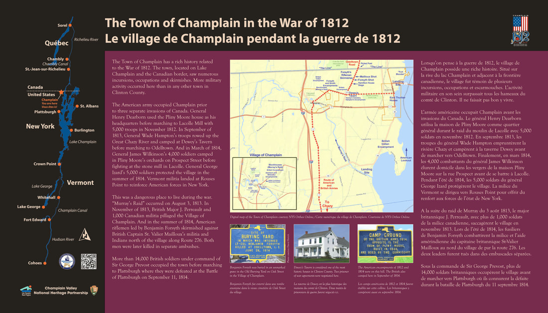
The Town of Champlain in the War of 1812
and
Dewey's Tavern
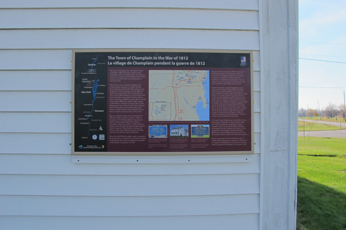
The Town of Champlain has a rich history related to the War of 1812. As a town bordering Canada and Lake Champlain, it saw numerous incursions, occupations and skirmishes. More military activity occurred here than in any other town in Clinton County.
The American army occupied Champlain three times before invading Canada. In November of 1812, General Henry Dearborn used the Pliny Moore house as his headquarters before marching to Lacolle Mill with 5,000 troops. In September of 1813, General Wade Hampton’s troops rowed up the Great Chazy River and camped at Dewey’s Tavern before marching to Odelltown. And in March of 1814, General James Wilkinson’s 4,000 troops camped in Pliny Moore’s orchards on Prospect Street before fighting at the stone mill in Lacolle. General George Izard’s 5,000 troops protected the village in the summer of 1814.
Many skirmishes and raids occurred around town. “Murray’s Raid” occurred on August 3, 1813. In November of 1813, British Major J. Perreault and 1,000 militia pillaged the Village of Champlain after several previous incursions. And in the summer of 1814, Lieut.-Col. Benjamin Forsyth’s Riflemen and Capt. St. Valier Mailloux’s militia and Indians had several skirmishes north of the village and along Route 276. Both men were killed in separate ambushes in June and August.
In August and September of 1814, 14,000 British soldiers under command of Sir George Prevost occupied the town before marching to Plattsburgh. After the Battle of Plattsburgh on September 11, a brigade remained until September 25.
Rouses Point was a landing site for Vermont militia crossing the lake. In 1816, the building of “Fort Blunder” was commenced on Island Point.
GPS Location: 44.988617503179555, -73.41306492096639
The American army occupied Champlain three times before invading Canada. In November of 1812, General Henry Dearborn used the Pliny Moore house as his headquarters before marching to Lacolle Mill with 5,000 troops. In September of 1813, General Wade Hampton’s troops rowed up the Great Chazy River and camped at Dewey’s Tavern before marching to Odelltown. And in March of 1814, General James Wilkinson’s 4,000 troops camped in Pliny Moore’s orchards on Prospect Street before fighting at the stone mill in Lacolle. General George Izard’s 5,000 troops protected the village in the summer of 1814.
Many skirmishes and raids occurred around town. “Murray’s Raid” occurred on August 3, 1813. In November of 1813, British Major J. Perreault and 1,000 militia pillaged the Village of Champlain after several previous incursions. And in the summer of 1814, Lieut.-Col. Benjamin Forsyth’s Riflemen and Capt. St. Valier Mailloux’s militia and Indians had several skirmishes north of the village and along Route 276. Both men were killed in separate ambushes in June and August.
In August and September of 1814, 14,000 British soldiers under command of Sir George Prevost occupied the town before marching to Plattsburgh. After the Battle of Plattsburgh on September 11, a brigade remained until September 25.
Rouses Point was a landing site for Vermont militia crossing the lake. In 1816, the building of “Fort Blunder” was commenced on Island Point.
GPS Location: 44.988617503179555, -73.41306492096639
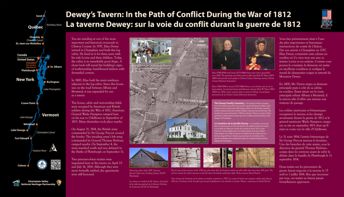
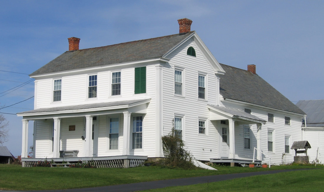
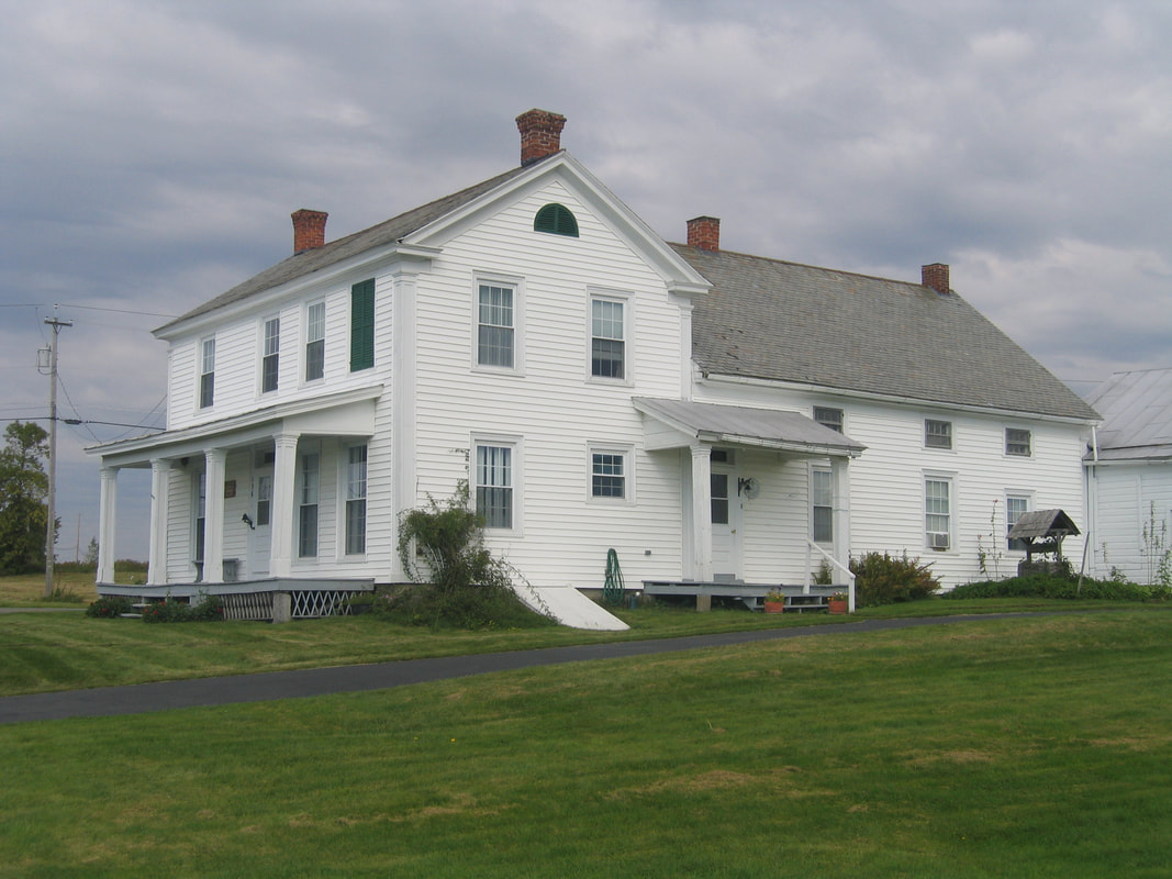
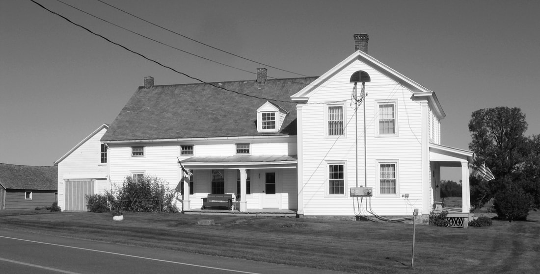
The Dewey family homestead is one of the oldest houses in the Town of Champlain and was witness to many important events during the War of 1812. The house was built by one of Champlain’s earliest settlers and its fields were occupied during the War of 1812 by both American and British troops. Two prisoner of war negotiation meetings were held at the house. Near the house was the Dewey family cemetery where the remains of American and British soldiers were buried. The former Dewey property is one of the most historic locations in Clinton County.
The Arrival of Elias Dewey in Champlain
In the late 1790s and early 1800s, many New Englanders arrived in the Town of Champlain from Massachusetts, Connecticut, Vermont and central New York. In 1797, Elias Dewey and his wife Lovisa settled here. Elias was born in Hebron, Connecticut on April 26, 1768, and died in Champlain on January 11, 1854. He married Lovisa Hamilton (July 29, 1773-May 19, 1846). She was born in Massachusetts and was the daughter of John Hamilton and Sarah Stone. The Hamiltons settled in Champlain north of the Dewey’s house.
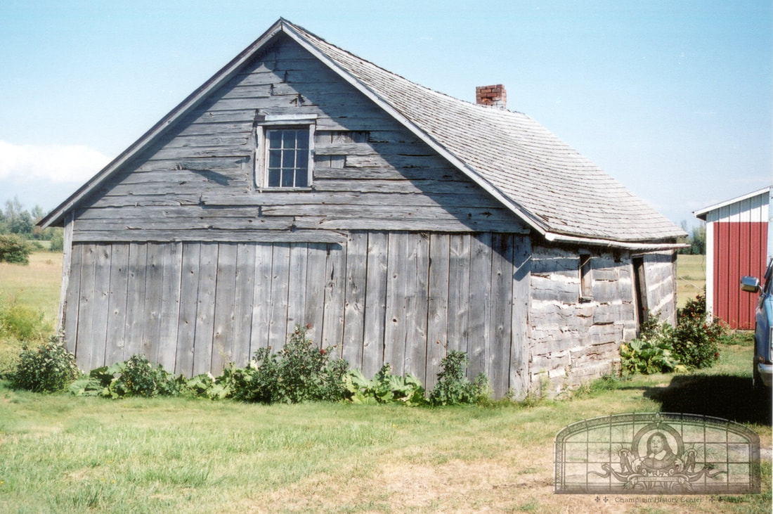
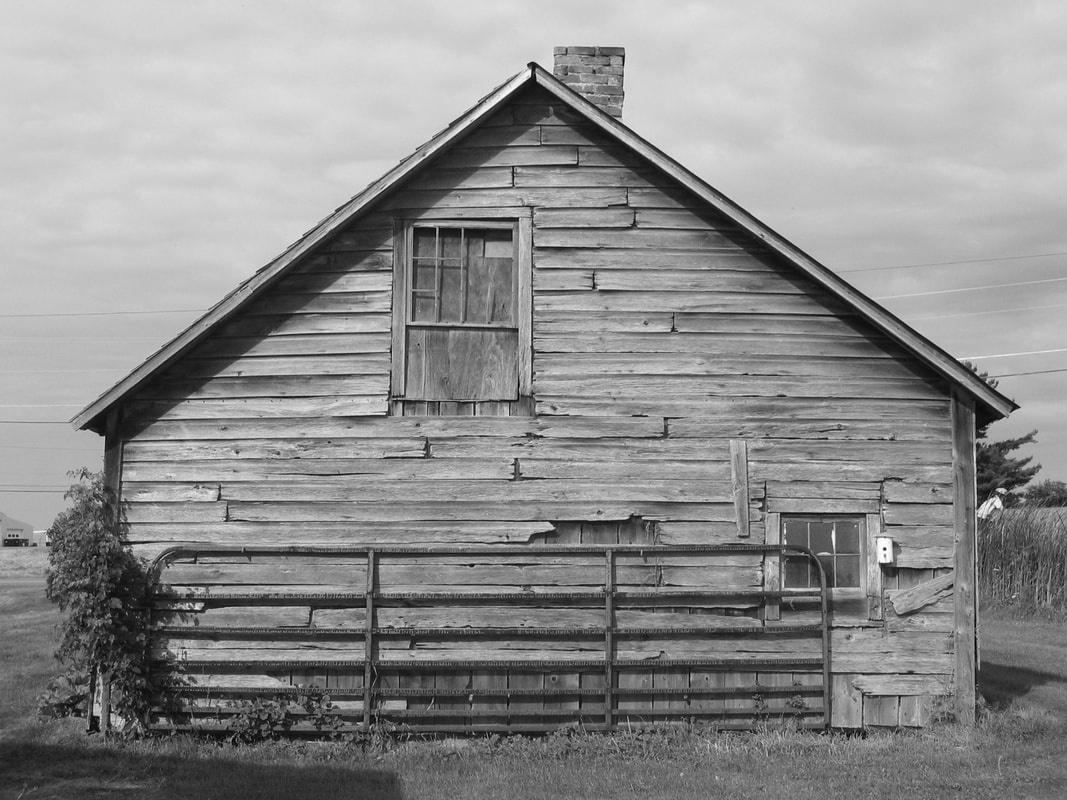
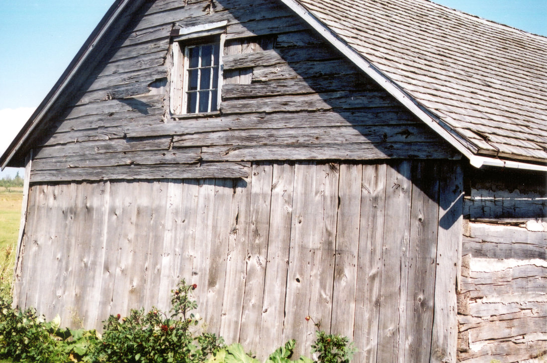
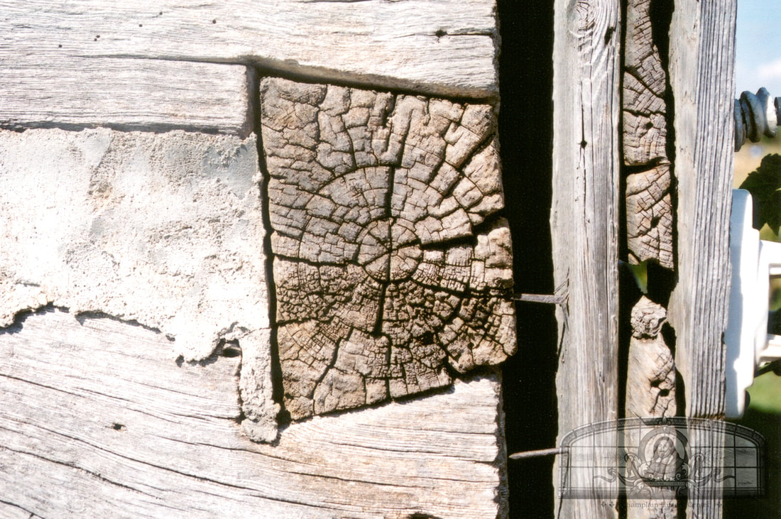
Elias Dewey purchased Lot 104 of 80 acres from his father-in-law, John Hamilton. Although a sawmill existed in Champlain, Elias chose to build a log house using logs that were hand hewed with a broad axe and adze. His family lived in this log house for two or three years. Elias’s daughter, Drusilla, was told that a blanket was placed over the front door to block the cold winter wind from entering the dwelling. Today, the 1797 log cabin still stands and is one of the oldest structures in Champlain. Its hand-hewed timbers and dovetailed corners are still clearly seen 224 years later.
In 1800, Elias built a 15-room frame house adjacent to his log cabin. He was fairly well-off by then and his house was built of exceptional workmanship. Since Elias’s house was on the main road from Albany to Canada, many travelers passed by and needed rest. This prompted him to build an addition on the back of his house that was used as an inn. With the addition, the entire tavern contained 22 rooms. By 1815, it was known as the “Elias Dewey Inn”.
The War of 1812
The War of 1812 started on June 18, 1812 and Champlain saw many incursions by the Canadian militia, British troops and Indians employed by the British army. Numerous skirmishes took place between the tavern and the border on the Route 276 road as well as on the hill off of upper Prospect Street. Champlain Town’s residents were in “perpetual fear” throughout the war.
In September 1813, General Wade Hampton planned to invaded Canada by way of Odelltown. His army of 3,000 to 4,000 troops camped in the fields surrounding Dewey’s Tavern and then marched up today’s Route 276 to the border. In Odelltown, his army was easily repulsed.
In March of 1814, General James Wilkinson planned to conquer Montreal. On March 30, his army of 4,000 soldiers marched from Dewey’s Tavern to Lacolle and engaged in battle around a large stone mill. Wilkinson was forced to withdraw after a two-hour battle with 13 killed and 128 wounded. The dead were buried in Canada but the wounded were taken back to the tavern. Drusilla Dewey, Elias’s 12-year-old daughter, remembered that the wounded soldiers were laid on the floors of the house and in the out-buildings (probably the log cabin and barn). The soldiers who died at the tavern were buried in the family cemetery in “nameless graves.”
On August 31 and September 1, 1814 British general George Prevost’s army of 14,000 soldiers crossed the border into Champlain. The left-wing of the Army camped in the fields near the Dewey and Hamilton houses.
On September 11, the Battle of Plattsburgh occurred and the British were defeated. Drusilla Dewey said that people in Champlain could hear the firing of the cannons in Plattsburgh. Drusilla remembered seeing the “flying soldiers” retreat back into Canada. Abandoned war material littered Route 9 for 20 miles. One brigade remained in Champlain until September 25.
Tradition says that when the British retreated, they left many of their wounded at Dewey’s Tavern. When the wounded died, they were buried in the Dewey family cemetery. Another story states that a British officer left his dispatch box at the house and it remained in the Dewey family for years. In 1936, it was owned by the writer of an article about Dewey’s Tavern.
The Signing of Prisoner of War Treaties at Dewey’s Tavern
During the war, both countries were eager to negotiate prisoner of war exchange agreements to reduce their prisoners. Four agreements were signed and two of these were signed at Dewey’s Tavern. On April 15, 1814, American Brig. Gen. John Winder and British Adjutant General Edward Baynes signed one agreement. The American government did not accept this agreement and it was renegotiated at the tavern on July 16.
GPS Location: 44.991543881094174, -73.41200458371618
A complete history of Dewey's Tavern as well as Champlain's role in the War of 1812 can be found in the 2010 Champlain Historic Calendar.
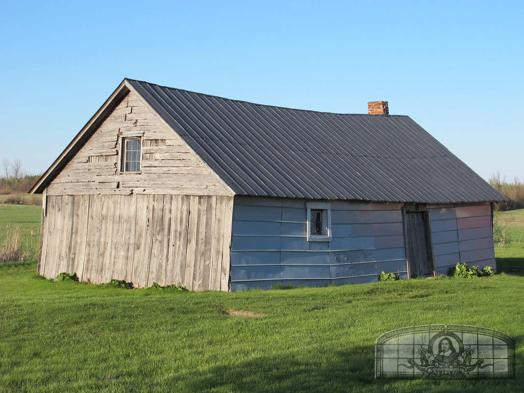
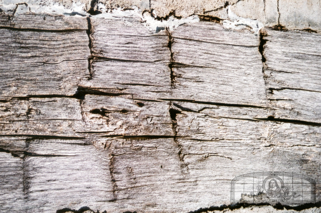
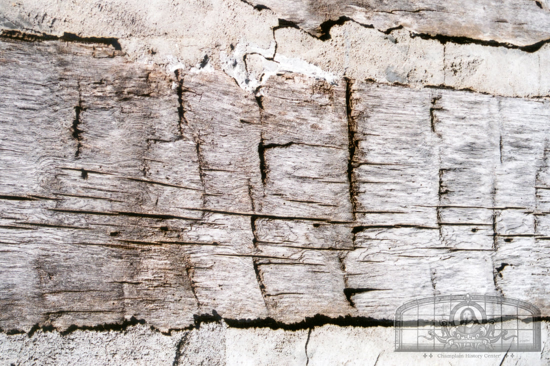
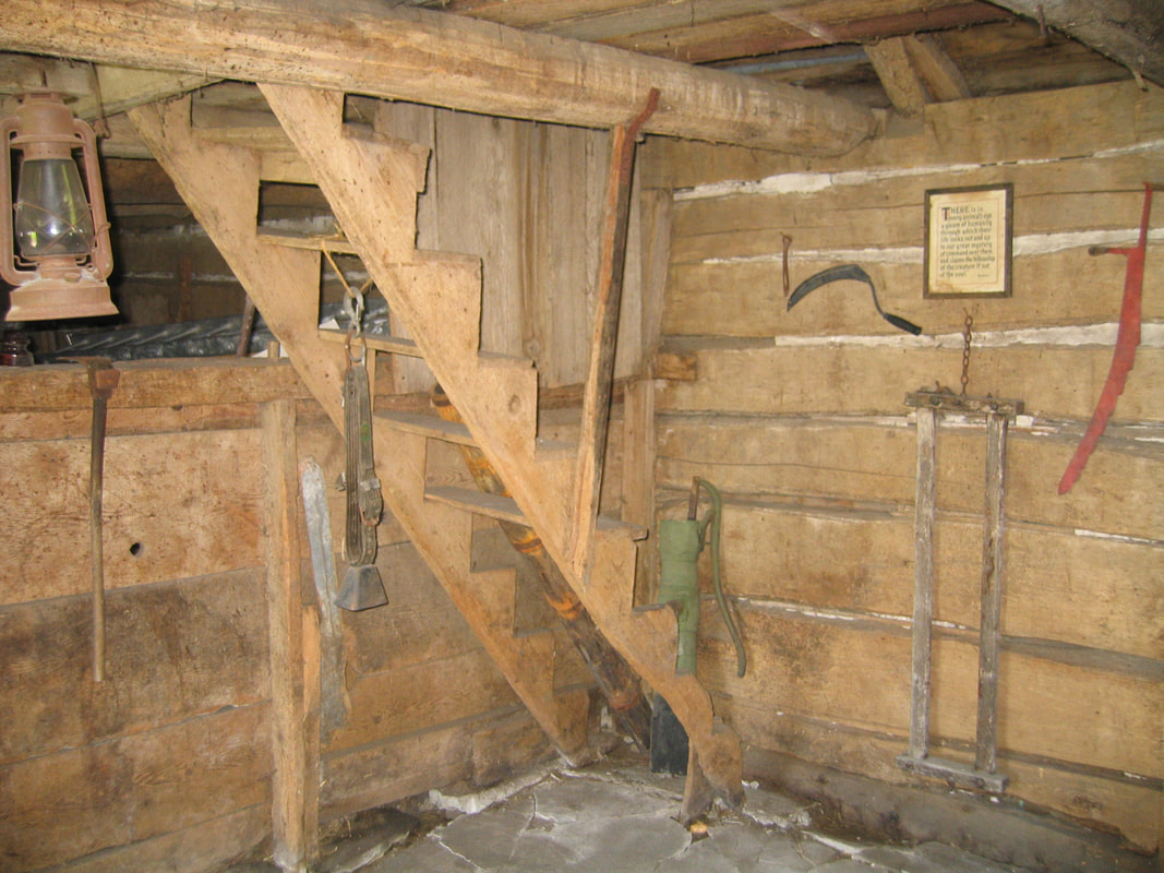
The original 1797 log cabin built by Elias Dewey still stands today and is used as a shed. The original ax and adze marks are clearly visible on the outside of the building. The interior reveals more about how the cabin was built. Injured American soldiers were cared for here in the shed after the failed offensive on the Lacolle Block House in March of 1814.
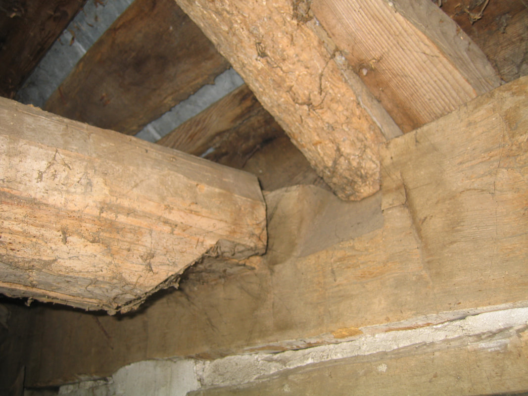
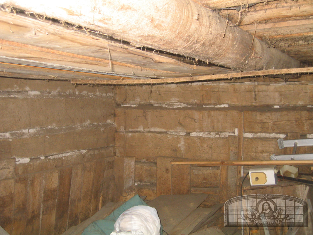
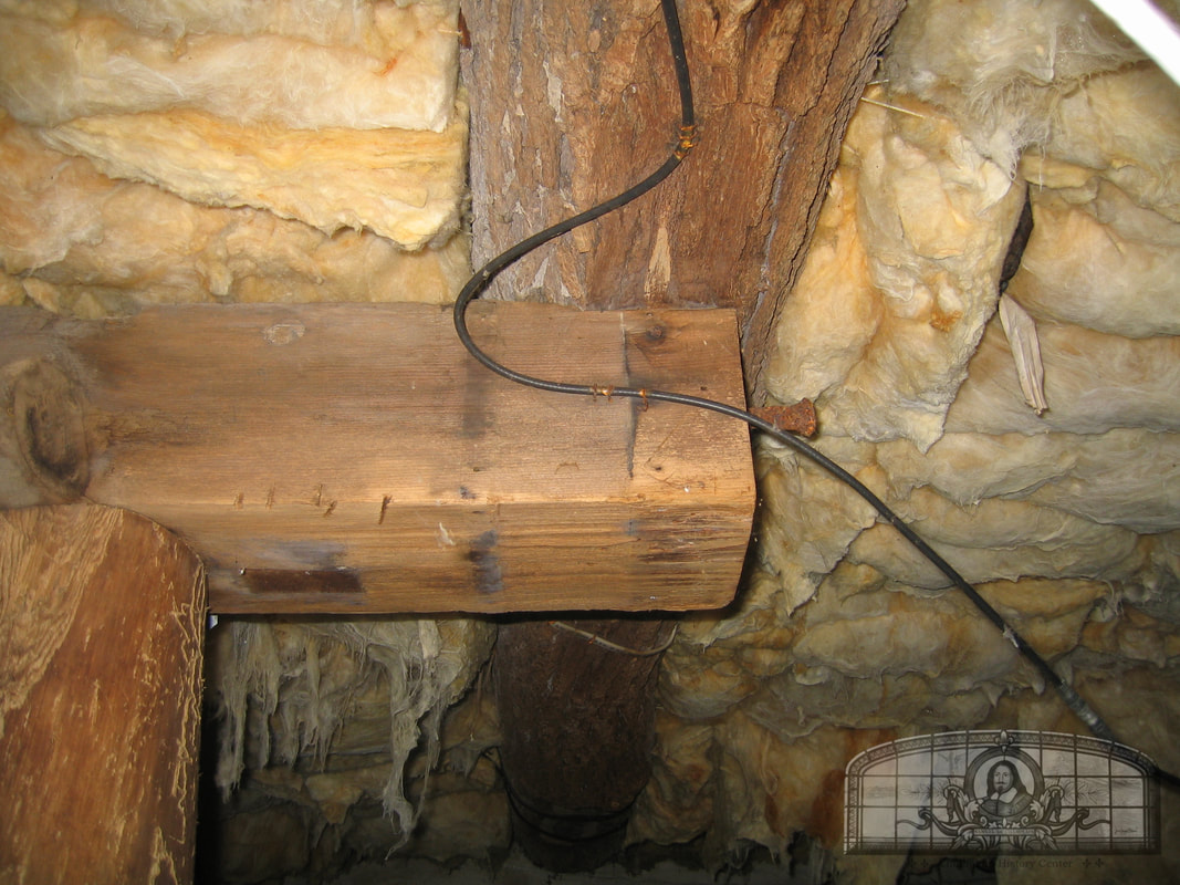
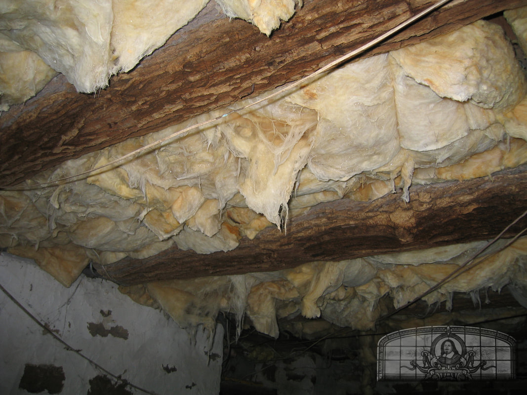
In 1800, Dewey built a two-story frame house using wood cut in a nearby sawmill. The floor joists in the basement are composed of huge logs that are still lined with bark.
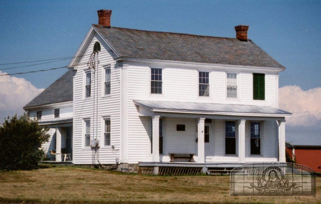
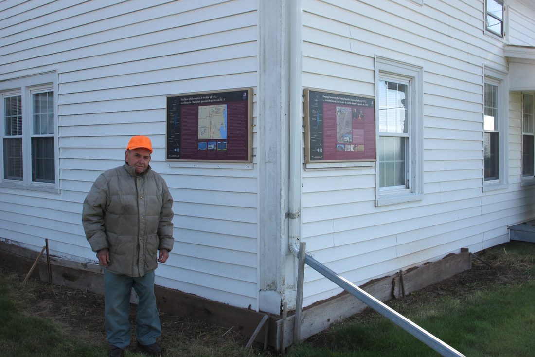
The late Joseph Louie Bedard at his house and farm, formerly the "Elias Dewey Inn," later known as "Dewey's Tavern." This is one of the most historic houses in Clinton County as officers from both armies stayed at and camped around the house. Two prisoner of war treaties between American and British agents were negotiated in this house. The panels are owned by the Town of Champlain and are now in the Dewey Family Cemetery and park across the road from the tavern which is also owned by the town.
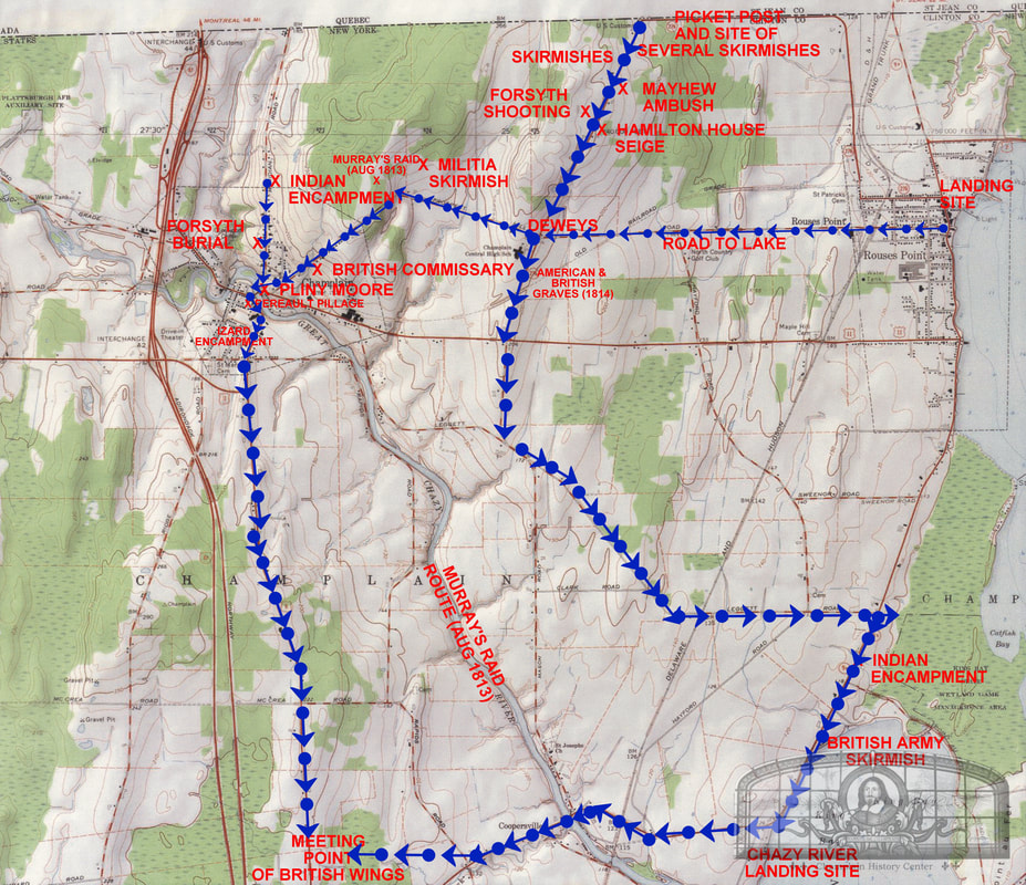
Maps created by David Patrick based on his research of the War of 1812 in Champlain. See the two Champlain historical calendars for 2006 and 2010 for more information.
St. Joseph's Church and Cemetery
Coopersville
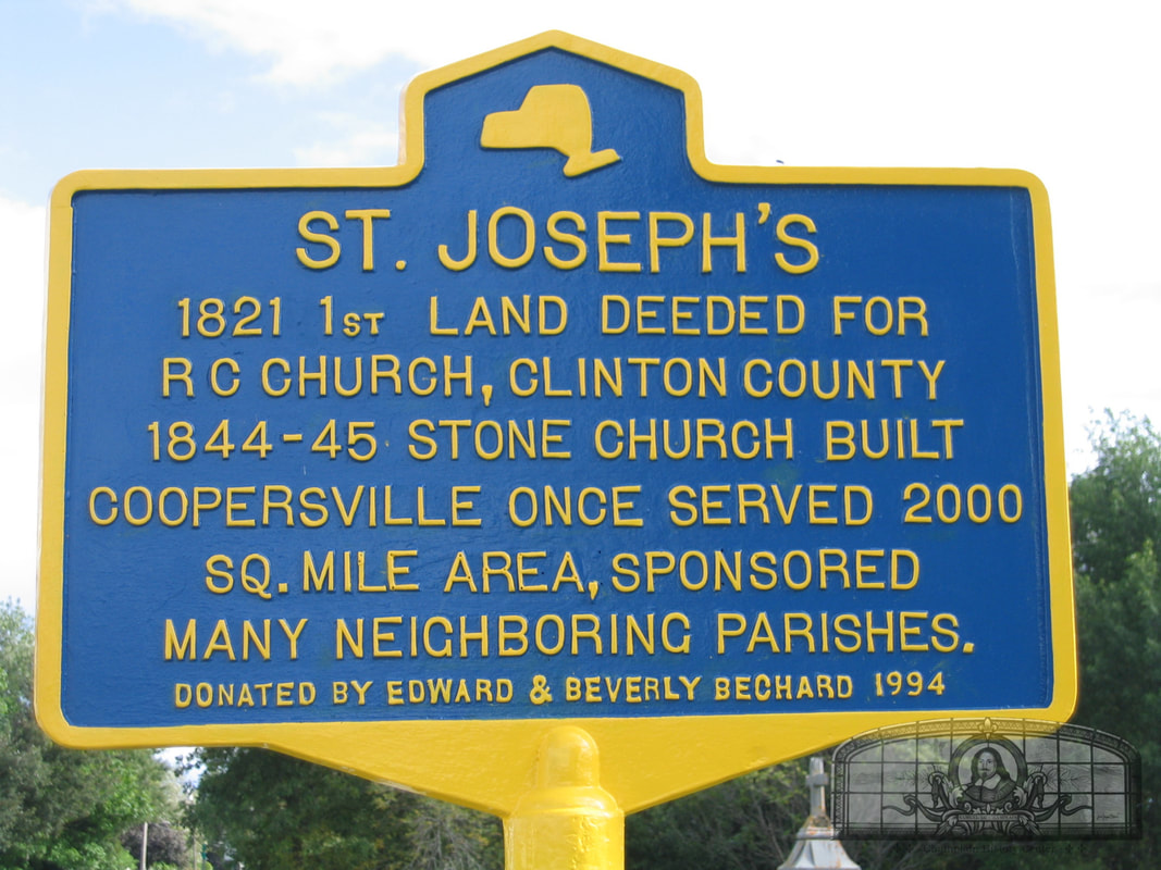
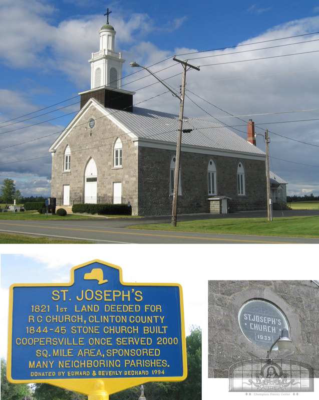
After the settlement of the French refugees near the lakeshore and along the Great and Little Chazy Rivers in the 1780s, religious meetings were held in the homes of Prisque Asselin, Amable Boileau, Francis Monty, Antoine Paulent, Amable Paulent or at a log schoolhouse near the present hamlet of Coopersville. During the War of 1812 (1812-1815), missionaries of all faiths fled or avoided the town and no religious services were held. By 1818, three years after the war, missionary Pierre M. Migneault came from Chambly, Quebec and held Mass for the first time in town. These visits highlighted the need for a Catholic church and Migneault convinced the French settlers to build a log chapel on the Great Chazy River bank where the old St. Joseph’s cemetery is today. A plot of land was purchased on Lot 115 on September 27, 1821, and a Catholic cemetery was established. In 1828, Father Victor Dugas arrived and became the first settled priest. He had one of the longest terms as pastor, and under his direction in 1843, a brick building was purchased nearby for use as a parsonage (this burned down in 1902). Construction of a stone church of 50x100 feet was started by Dugas. In July of 1844, Father Louis Lapic took over and in September Dugas died. The church was completed in 1845 at a cost of $3,124 (about $94,000 today). On June 21, 1934, lightning struck the bell tower and the church burned to the ground with about 2,000 people watching along the road. The church was rebuilt and is the church standing today.
The cemetery at St. Joseph’s Church was first laid out in 1821 after the purchase of land on September 27. The cemetery was on the edge of the river bank and was two acres in size. Many of the French settlers had been buried on the lakeshore in the "Refugee Graveyard," but after the establishment of this cemetery, they were buried here. The second cemetery next to the church was established on June 28, 1931.
GPS: 44.94784262344072, -73.41138183967907
The cemetery at St. Joseph’s Church was first laid out in 1821 after the purchase of land on September 27. The cemetery was on the edge of the river bank and was two acres in size. Many of the French settlers had been buried on the lakeshore in the "Refugee Graveyard," but after the establishment of this cemetery, they were buried here. The second cemetery next to the church was established on June 28, 1931.
GPS: 44.94784262344072, -73.41138183967907
Refugee Graveyard
wip
On November 27, 2010, the Refugee Graveyard (also known as Wiley's Point North) was rediscovered. All of the gravestones were under tall grass and several inches of sod. Seven were uncovered that day and the writing on the stones were matched to Hugh McLellan’s cemetery transcriptions made in 1922. That next spring, landowner Francis Laurin, who had farmed this land since he was a youngster, demonstrated the size of the fenced in cemetery as he remembered it. He thought the graveyard might have been 60x60 feet but the true size is unknown. When Prisque Asselin and Jacques Rouse died in the early 1800s, this site would have looked very different as wooden crosses or other markers would have been scattered throughout the field.
Historic Marker Dedication
On July 10, 2026, a blue and yellow historic marker for the Refugee Graveyard was dedicated at the roadside as part of the America250 celebration in the Town of Champlain. Several descendants of Prisque Asselin (Ashline) and Robert Forsyth attended (families connected by marriage). The marker is near 2237 Lake Shore Rd., Champlain and the GPS Coordinates of the graveyard are: 44.915047572384495, -73.37873920206478. The graveyard is in a large field on private property. Clinton County legislator Calvin Castine and his organization, Woodmen Life Chapter 462, sponsored the marker. The 2012 Champlain Historic Calendar chronicled the Town of Champlain’s cemeteries and lost burying grounds, including this one.
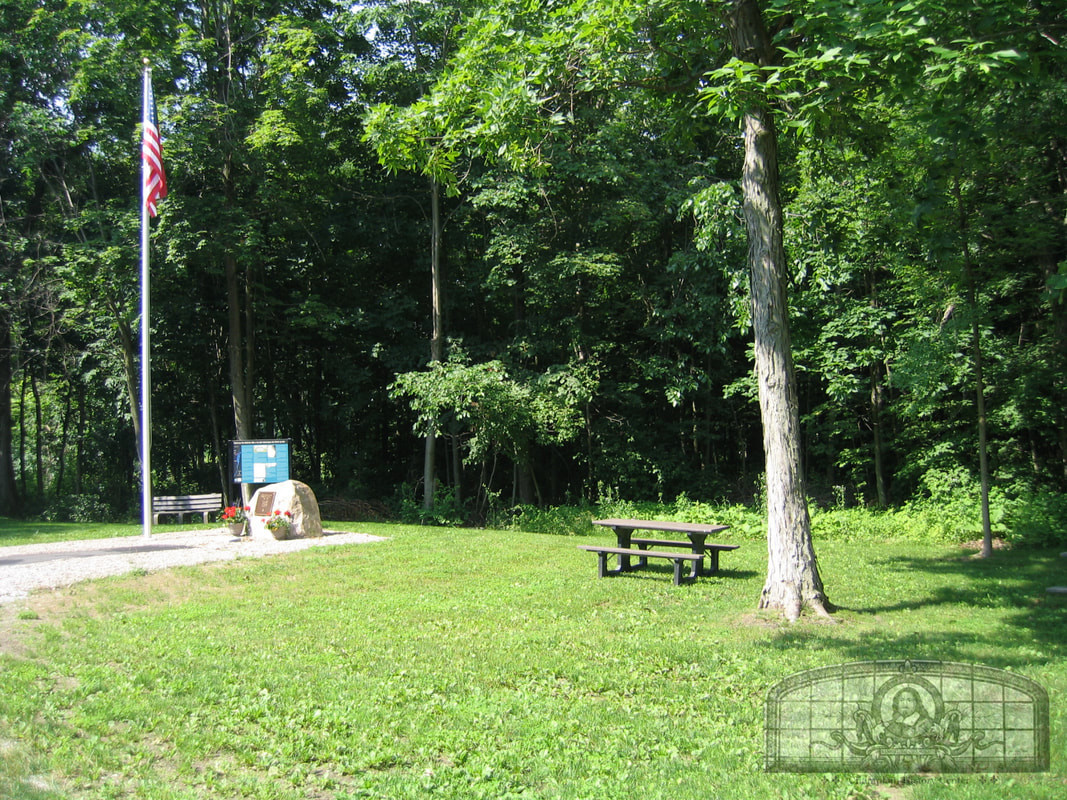
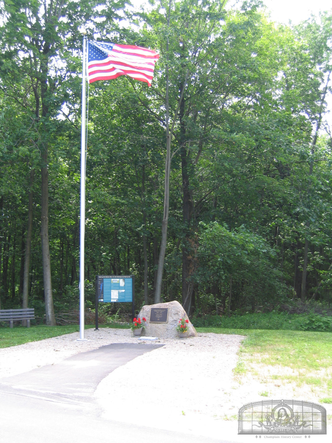
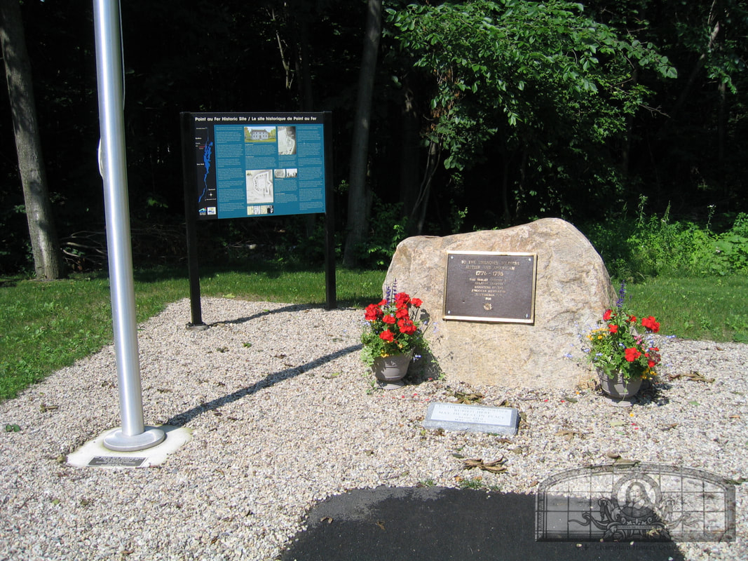
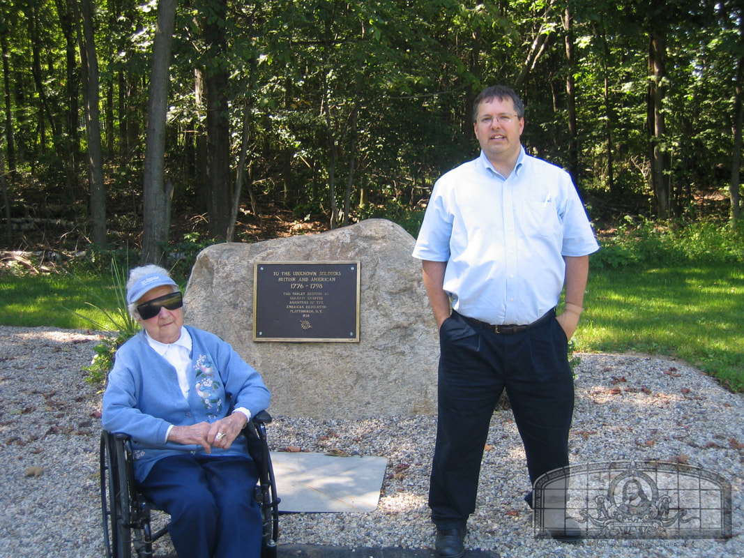
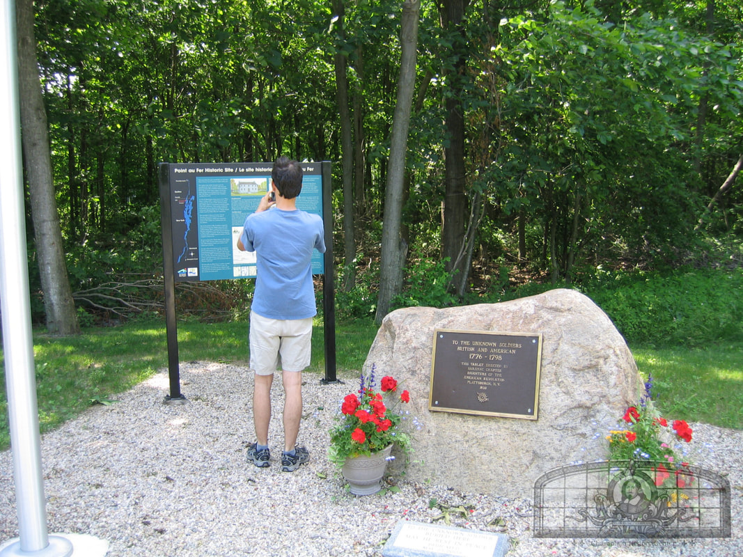
Point au Fer Historic Site
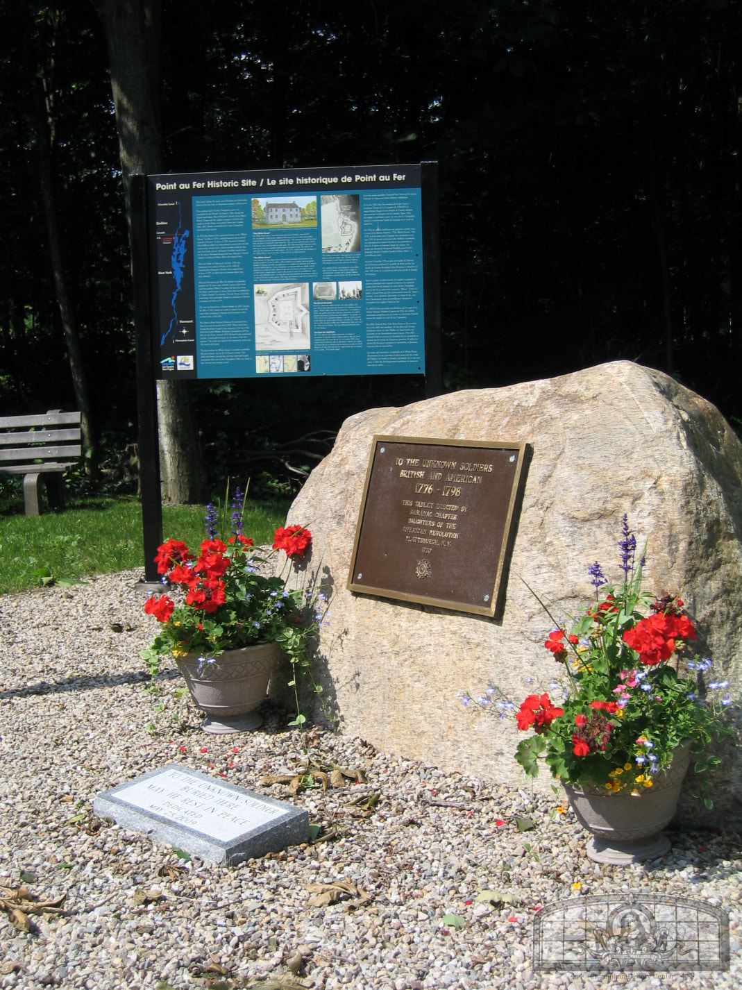
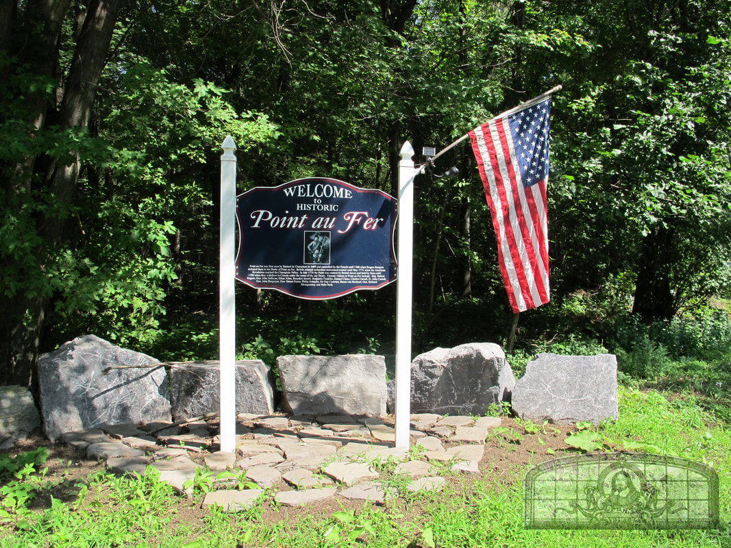
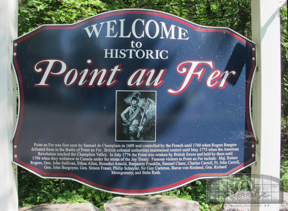
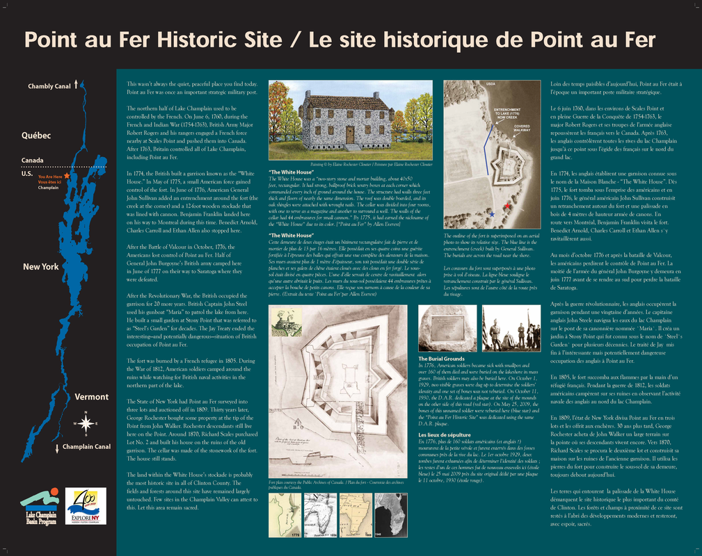
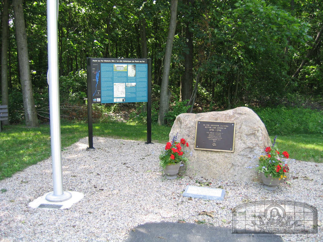
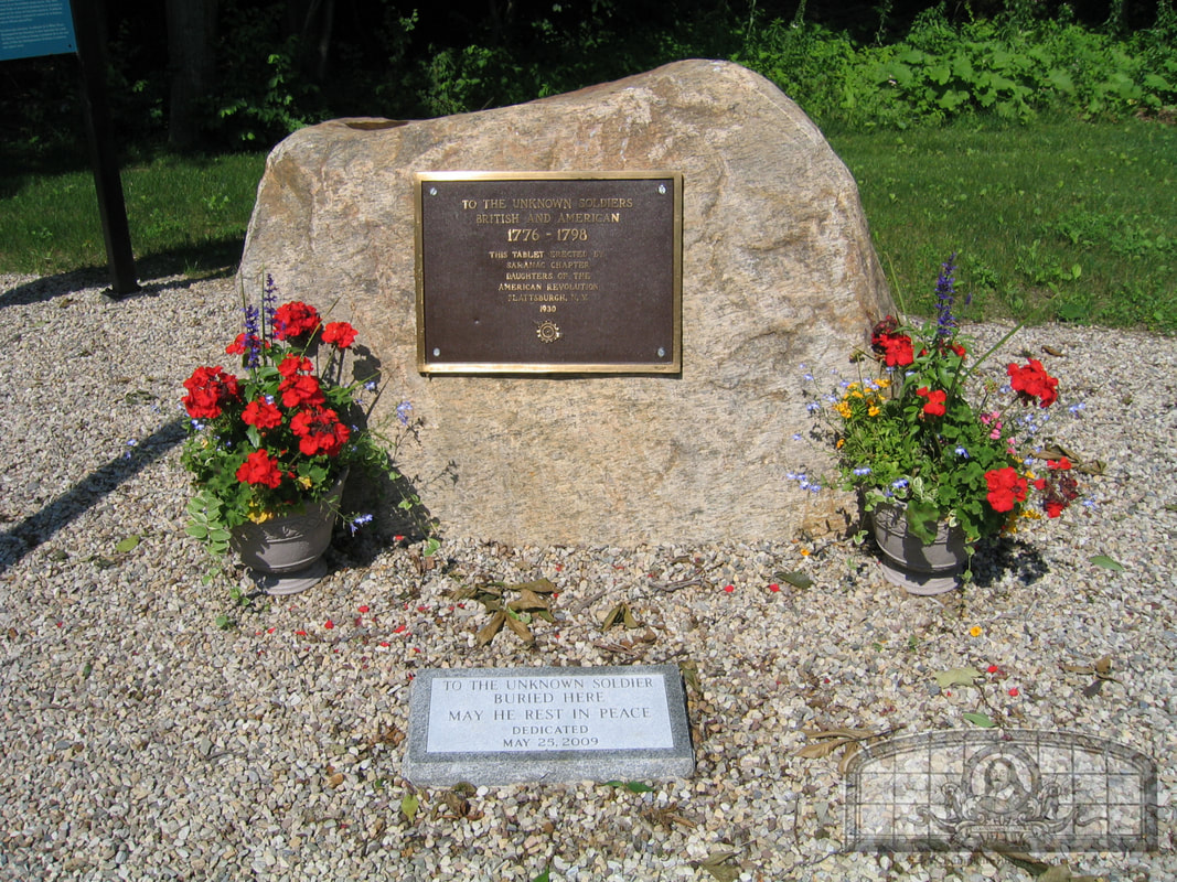
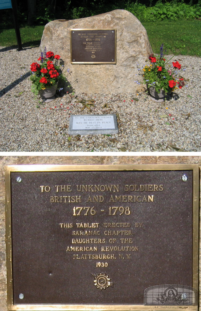
Prior to 1763, the northern half of Lake Champlain was controlled by the French. On June 6, 1760, during the French and Indian War (1754-1763), British Army major Robert Rogers and his Rangers engaged the French near here at Scales Point and pushed them into Canada. Britain was now in control of Point au Fer and in three years controlled all of Quebec.
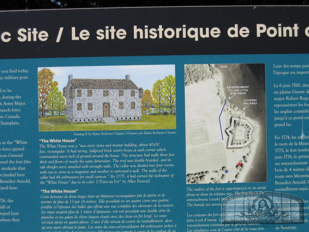
In 1774, the British built a garrison known as the “White House”. In May of 1775, a small American force gained control of the fort and in June of 1776 American General John Sullivan added an entrenchment around the fort (the creek at the corner) and a 12-foot-tall wooden stockade that was lined with cannon. It was during this time that Benjamin Franklin landed here on his way to Montreal. Benedict Arnold, Charles Carroll and Ethan Allen also stopped here.
After the Battle of Valcour in October of 1776, the Americans lost control of Point au Fer. Half of General John Burgoyne’s British army camped here in June of 1777 on their way to Saratoga where they were defeated.
After the Revolutionary War, the British occupied the garrison for 20 more years. British Captain John Steel used his gunboat “Maria” to patrol the lake off of Point au Fer. He built a small garden at Stony Point that for 90 years was referred to as “Steel’s Garden”. At the enactment of Jay’s Treaty on June 1, 1796, the British left Point au Fer and the United States.
In 1805, a French refugee burned down the fort. American soldiers during the War of 1812 (1812-14) camped around the ruins while watching for British naval activities in the northern part of the lake.
In 1809, Point au Fer was surveyed into three lots and auctioned off by the State of New York. In 1839, George Rochester bought some property at the tip of the Point from John Walker and his descendants still live in the area. Around 1870, Richard Scales purchased Lot No. 2 and built his house on the ruins of the old garrison. The cellar was made of the stonework of the fort. The house is still standing today.
The land within the White House’s stockade is probably the most historic site in all of Clinton County. Except for the plow, the fields and forests around this site have remained largely untouched. Few sites in Clinton County can attest to this. Let this area remain sacred.
GPS: 44.94410249604553, -73.35243764692687
In 1774, the British built a garrison known as the “White House”. In May of 1775, a small American force gained control of the fort and in June of 1776 American General John Sullivan added an entrenchment around the fort (the creek at the corner) and a 12-foot-tall wooden stockade that was lined with cannon. It was during this time that Benjamin Franklin landed here on his way to Montreal. Benedict Arnold, Charles Carroll and Ethan Allen also stopped here.
After the Battle of Valcour in October of 1776, the Americans lost control of Point au Fer. Half of General John Burgoyne’s British army camped here in June of 1777 on their way to Saratoga where they were defeated.
After the Revolutionary War, the British occupied the garrison for 20 more years. British Captain John Steel used his gunboat “Maria” to patrol the lake off of Point au Fer. He built a small garden at Stony Point that for 90 years was referred to as “Steel’s Garden”. At the enactment of Jay’s Treaty on June 1, 1796, the British left Point au Fer and the United States.
In 1805, a French refugee burned down the fort. American soldiers during the War of 1812 (1812-14) camped around the ruins while watching for British naval activities in the northern part of the lake.
In 1809, Point au Fer was surveyed into three lots and auctioned off by the State of New York. In 1839, George Rochester bought some property at the tip of the Point from John Walker and his descendants still live in the area. Around 1870, Richard Scales purchased Lot No. 2 and built his house on the ruins of the old garrison. The cellar was made of the stonework of the fort. The house is still standing today.
The land within the White House’s stockade is probably the most historic site in all of Clinton County. Except for the plow, the fields and forests around this site have remained largely untouched. Few sites in Clinton County can attest to this. Let this area remain sacred.
GPS: 44.94410249604553, -73.35243764692687
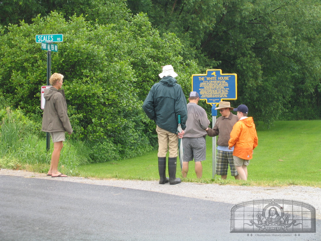
Blue and Yellow Historic Marker at Point au Fer
THE “WHITE HOUSE”
IN 1774, A TWO-STORY WHITE STONE
GARRISON WAS BUILT HERE BY THE BRITISH,
FORTIFIED BY AMERICAN GEN. JOHN SULLIVAN
WITH ENTRENCHMENT AND STOCKADE IN 1776
AND DESTROYED BY FIRE IN 1805.
BRITISH OCCUPATION 1774-1775 AND 1776-1796.
AMERICAN OCCUPATION MAY 1775-OCT. 1776.
ENCAMPMENT OF THE BRITISH ARMY JUNE 1777
DURING BURGOYNE’S CAMPAIGN TO SARATOGA.
ALSO NEAR HERE AT SCALES POINT WAS
ROGERS’ RANGERS BATTLE OF JUNE 6, 1760.
IN 1774, A TWO-STORY WHITE STONE
GARRISON WAS BUILT HERE BY THE BRITISH,
FORTIFIED BY AMERICAN GEN. JOHN SULLIVAN
WITH ENTRENCHMENT AND STOCKADE IN 1776
AND DESTROYED BY FIRE IN 1805.
BRITISH OCCUPATION 1774-1775 AND 1776-1796.
AMERICAN OCCUPATION MAY 1775-OCT. 1776.
ENCAMPMENT OF THE BRITISH ARMY JUNE 1777
DURING BURGOYNE’S CAMPAIGN TO SARATOGA.
ALSO NEAR HERE AT SCALES POINT WAS
ROGERS’ RANGERS BATTLE OF JUNE 6, 1760.
A complete history of Point au Fer in the French and Indian War and Revolutionary War can be found in the 2017 Champlain Historic Calendar which is still on sale.
Village of Rouses Point
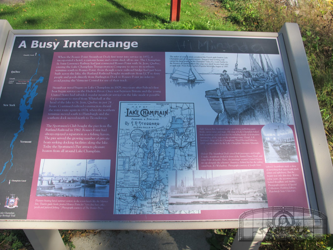
Station House Hotel and Steamboat Landing
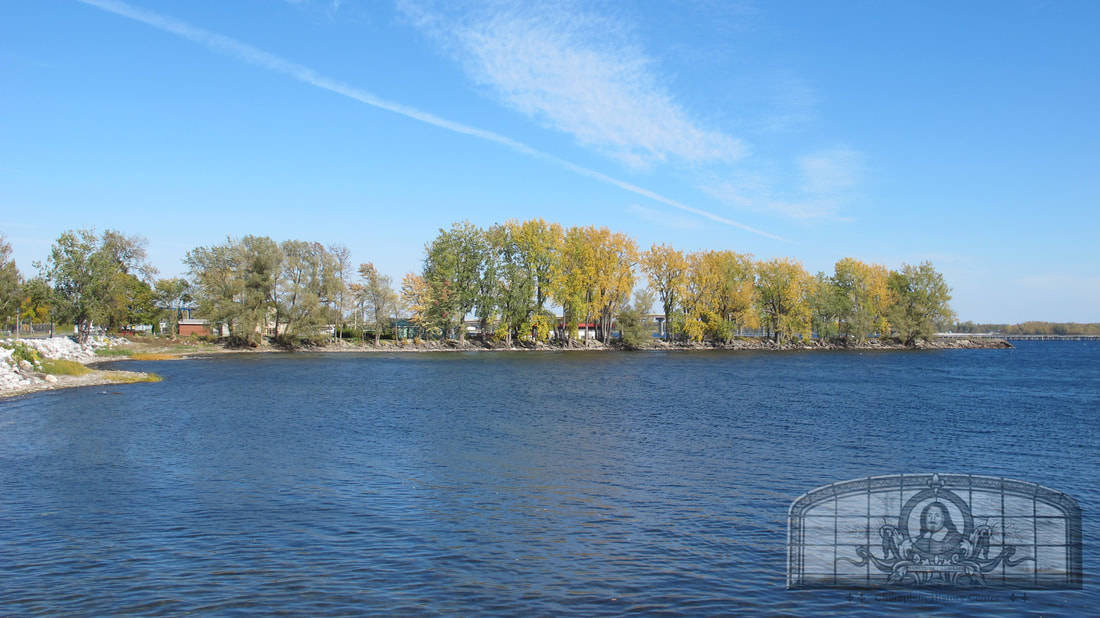
Sportsman Pier
Montgomery Street
Multiple Interpretive Panels and Blue and Yellow Markers in this Area:
GPS Location: 44.99519265598474, -73.36080828316834
Jacques Rouse
Sportsman Pier
Montgomery Street
Jacques Rouse was born about 1753 in Shepody, Nova Scotia and was living in Quebec City in 1759 when it was conquered by British General James Wolfe during the French and Indian War. Rouse joined the revolution in the fall of 1775 when he volunteered with the invading American forces under General Richard Montgomery. He was present during the Battle of Quebec and retreated with the American forces after the invasion’s failure. He later participated at the Battle of Three Rivers and was present at the Battles of Long Island, Bennington and Saratoga. In the fall of 1778, he enlisted as a private in Moses Hazen’s 2nd Canadian Regiment at Peekskill, NY and served until the end of the war. On the 9th of July 1790, he was appointed Captain of a Company in the Regiment of Militia in the County of Clinton by the State of New York.
Jacques Rouse is said to have settled in this area around 1783 (he settled near the Chazy Line prior to moving to Rouses Point). Rouse was awarded lots 132 and 136 in the balloting. By 1800 he owned lots 16, 27, 43, 50, 86, 99, 113, 128, 134, 136, and 192 from the Canadian and Nova Scotia Refugee Tract as well as lots 85 and 86 from the Moorsfield Grant that he bought from Pliny Moore. He would own and sell more land over the years.
After Rouse settled in present day Rouses Point, he built a tavern, orchard and garden and a dock at a sandy point of land that was just south of Island Point where Fort Blunder and Fort Montgomery were later built. Rouse would later own lots on the Commons but the Federal Government bought this land between 1812 and 1818. In return the Federal Government built a frame house for his family near the lakeshore on Montgomery Street. This house was removed in the 1850s when the Ogdensburg railroad built a wharf.
Prior to his death around 1821, Rouse moved back to the Chazy line and lived on lot 16. He is believed to be buried in the adjacent "Refugee Graveyard" (lot 15) with his wife and some of their children.
Contributed by Robert St. John
Jacques Rouse is said to have settled in this area around 1783 (he settled near the Chazy Line prior to moving to Rouses Point). Rouse was awarded lots 132 and 136 in the balloting. By 1800 he owned lots 16, 27, 43, 50, 86, 99, 113, 128, 134, 136, and 192 from the Canadian and Nova Scotia Refugee Tract as well as lots 85 and 86 from the Moorsfield Grant that he bought from Pliny Moore. He would own and sell more land over the years.
After Rouse settled in present day Rouses Point, he built a tavern, orchard and garden and a dock at a sandy point of land that was just south of Island Point where Fort Blunder and Fort Montgomery were later built. Rouse would later own lots on the Commons but the Federal Government bought this land between 1812 and 1818. In return the Federal Government built a frame house for his family near the lakeshore on Montgomery Street. This house was removed in the 1850s when the Ogdensburg railroad built a wharf.
Prior to his death around 1821, Rouse moved back to the Chazy line and lived on lot 16. He is believed to be buried in the adjacent "Refugee Graveyard" (lot 15) with his wife and some of their children.
Contributed by Robert St. John
Wayside Interpretive Panels
Sportsman Pier
Montgomery Street
Rouses Point History & Welcome Center
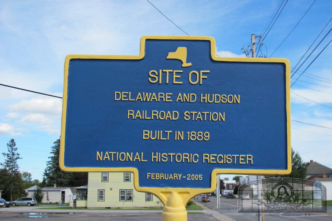
Delaware and Hudson Railroad Station
Pratt Street & Manor Drive
GPS Location: 44.99497799449941, -73.37112786027994
Ezra Thurber's Home
Lake Street
GSP Location: 44.97939701626099, -73.36370884366342
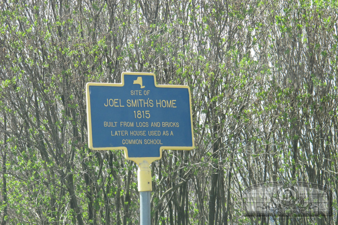
Joel Smith's Home
Lake Street
GPS Location: 44.97669354628241, -73.36365502805023
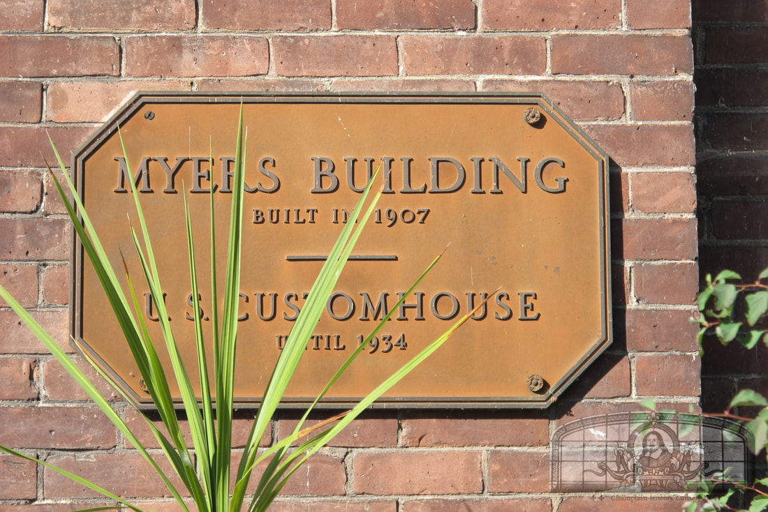
F.W. Myers Building
Lake Street
GPS Location: 44.994222513096936, -73.36504433587966
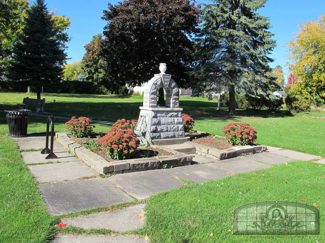
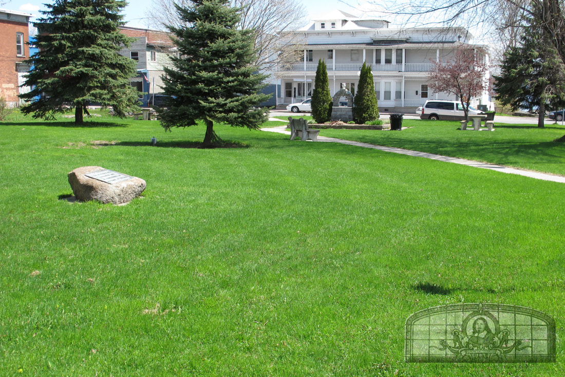
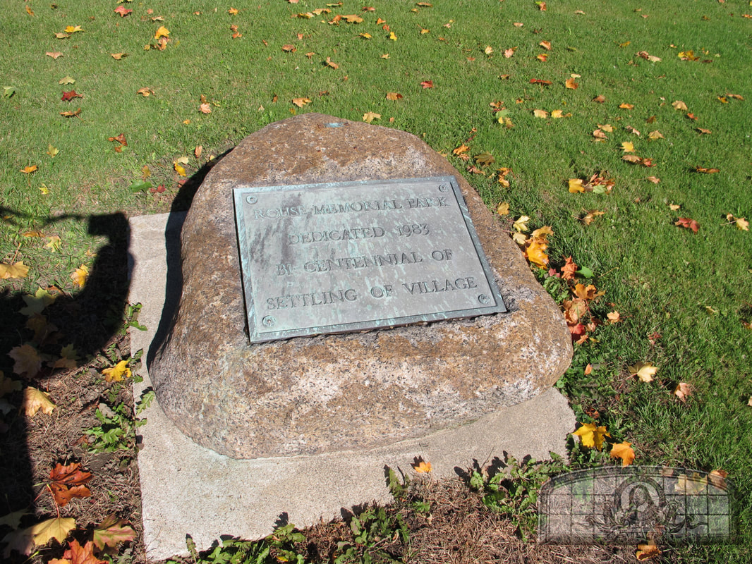
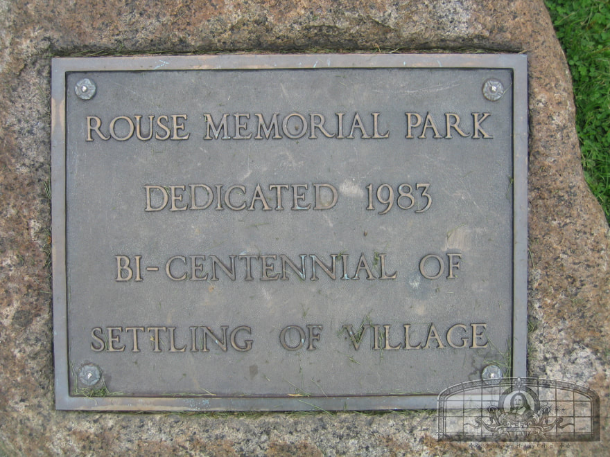
Rouse Memorial Park
Lake Street
GPS Location: 44.992586036767875, -73.36456377922437
Fort Montgomery
Bridge Road
GPS Location: 44.99985596418595, -73.35860389593559
Important copyright notice
All wayside interpretive panels were sponsored by the Lake Champlain Basin Program. All modern photos are copyright by the owner of the photograph.